|
search place name
|
||
Kyaukdaga Paya (Myanmar)Kyaukdaga Paya is a town in Myanmar. An overview map of the region around Kyaukdaga Paya is displayed below.
regional and 3d topo map of Kyaukdaga Paya, Myanmar ::

Kyaukdaga Paya airports ::
The nearest airport is RGN - Yangon Intl, located 122.5 km south of Kyaukdaga Paya.
Other airports nearby include SNW - Thandwe (167.8 km west), Nearby towns ::
Tayawgon (1.9km south) //
Sangyi (2.6km north east) //
Pettan (2.6km south west) //
Mokka (2.6km south west) //
Pettangyi (3.5km west) //
Seinkanlan Taungzu (4.0km north west) //
Nyaungthonbin (4.0km north west) //
Ingyingon (4.0km south west) //
Pettangale (4.0km south west) //
Seinkanlan Myaukzu (5.1km north west) //
Ngahlasan (5.1km south east) //
Payagwin (5.6km north) //
Kyaungwa (5.6km east) //
Kaingbyingyi (5.6km west) //
Kwetma (5.8km south) //
Udo Kywelanzu (5.8km south) //
Banbwegon (6.5km north east) //
Thin-aing (6.5km south west) //
Palegwin Taungzugyi (7.4km south) //
Indawtha (7.6km north) //
Sabyuzu (7.3km west) //
Nyaungbintha (7.6km south) //
Le-uzu (7.7km north west) //
Sanizu (7.7km south west) //
Hlebyindin (8.2km north west) //
Thayaw (8.0km north west) //
Sanbok (8.0km south east) //
Kyaukkwet (10.2km north east) //
Gonnyindan (10.2km north west) //
[all distances 'as the bird flies' and approximate] 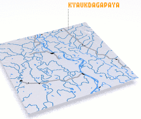 Places with similar names to Kyaukdaga Paya, Myanmar :: Disclaimer :: Information on this page comes without warranty of any kind |
||
|
Where is Kyaukdaga Paya? Elevation and coordinates ::
Latitude (lat): 17°58'0"N Longitude (lon): 95°48'0"E
Elevation (approx.): 43m (map arrows pan, magnifying glasses zoom) |
||
|
Visiting Kyaukdaga Paya? Hotel/Accommodation ::
Book a hotel in Kyaukdaga Paya Travel Guide ::
Buy a travel guide for Myanmar rental cars ::
car rental offers GPS waypoint ::
download a GPX waypoint (PoI) of Kyaukdaga Paya for your GPS receiver
|
||