|
search place name
|
||
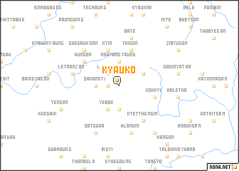
Kyauk-o (Myanmar)Kyauk-o is a town in Myanmar. An overview map of the region around Kyauk-o is displayed below.
regional and 3d topo map of Kyauk-o, Myanmar ::
Kyauk-o airports ::
The nearest airport is SNW - Thandwe, located 172.6 km south west of Kyauk-o.
Other airports nearby include HEH - Heho (192.5 km north east), Nearby towns ::
Myinnigon (1.7km west) //
Legaing (2.5km north west) //
Shabok (3.7km south) //
Ngayangyaung (3.7km north) //
Sakangyi (3.5km west) //
Tatkon (4.0km north east) //
Yebok (4.1km south west) //
Thigon (5.8km north) //
Kokkyi (5.6km east) //
Nyaungbuget (5.6km east) //
Kyin (5.8km north) //
Kyetthungin (6.6km south east) //
Wungon (6.4km north west) //
Bayè (7.6km north) //
Hlandin (7.6km south) //
Letpanzan (7.2km west) //
Gwedauksan (7.6km north west) //
Satsuwa (8.2km south west) //
Putchaydu (9.1km south east) //
[all distances 'as the bird flies' and approximate] 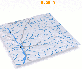 Places with similar names to Kyauk-o, Myanmar ::
Disclaimer :: Information on this page comes without warranty of any kind |
||
|
Where is Kyauk-o? Elevation and coordinates ::
Latitude (lat): 19°27'0"N Longitude (lon): 95°34'0"E
Elevation (approx.): 235m (map arrows pan, magnifying glasses zoom) |
||
|
Visiting Kyauk-o? Hotel/Accommodation ::
Book a hotel in Kyauk-o Travel Guide ::
Buy a travel guide for Myanmar rental cars ::
car rental offers GPS waypoint ::
download a GPX waypoint (PoI) of Kyauk-o for your GPS receiver
|
||