|
search place name
|
||
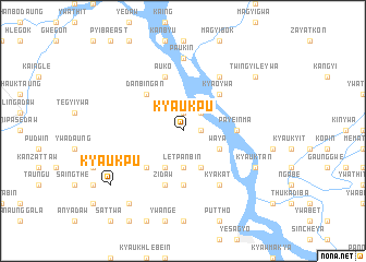
Kyaukpu (Myanmar)Kyaukpu is a town in Myanmar. An overview map of the region around Kyaukpu is displayed below.
regional and 3d topo map of Kyaukpu, Myanmar ::
Kyaukpu airports ::
The nearest airport is MDL - Mandalay Intl, located 82.3 km east of Kyaukpu.
Other airports nearby include HEH - Heho (199.5 km south east), Nearby towns ::
Mauale (1.9km north) //
Mautaung (1.7km east) //
Mauaukseik (2.5km north east) //
Letpanbin (3.7km south) //
Thebon East (4.1km south west) //
Kyunbobin (4.1km south east) //
Waya (3.9km south east) //
Thebon West (5.1km south west) //
Kanmadaw (5.1km south west) //
Thebon (5.1km south west) //
Danbingan (5.1km north west) //
Kyaoywa (5.1km north east) //
Payeinma (5.2km east) //
Seywa (5.6km south) //
Auko (5.8km north) //
Zidaw (5.8km south) //
Shwepan (6.5km north east) //
Kyakat (6.5km south east) //
Thazi (6.5km south east) //
Paukin (7.4km north) //
Kyauktan (7.8km south east) //
Myebyugyin (9.0km south west) //
Kyaukpu (8.9km south west) //
Twingyileywa (8.8km north east) //
[all distances 'as the bird flies' and approximate] 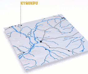 Places with similar names to Kyaukpu, Myanmar ::
Disclaimer :: Information on this page comes without warranty of any kind |
||
|
Where is Kyaukpu? Elevation and coordinates ::
Latitude (lat): 21°44'0"N Longitude (lon): 95°11'0"E
Elevation (approx.): 78m (map arrows pan, magnifying glasses zoom) |
||
|
Visiting Kyaukpu? Hotel/Accommodation ::
Book a hotel in Kyaukpu Travel Guide ::
Buy a travel guide for Myanmar rental cars ::
car rental offers GPS waypoint ::
download a GPX waypoint (PoI) of Kyaukpu for your GPS receiver
|
||