|
search place name
|
||
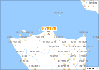
Kyet Yo (Rakhine, Myanmar)Kyet Yo is a town in the Rakhine region of Myanmar. An overview map of the region around Kyet Yo is displayed below.
regional and 3d topo map of Kyet Yo, Myanmar ::
Kyet Yo airports ::
The nearest airport is KYP - Kyaukpyu, located 60.7 km north of Kyet Yo.
Other airports nearby include SNW - Thandwe (85.9 km south east), AKY - Sittwe (158.8 km north west), Nearby towns ::
Zayatkonhkin (1.8km east) //
Pyagyi (1.8km east) //
Thitpôn (1.8km west) //
Myawdaw U (2.6km north east) //
Ngakechidwin (2.6km north west) //
Thinbaungchan (3.7km south) //
Buye-myit (4.0km south east) //
Taungbyi (4.0km south west) //
Palindaw (4.0km north west) //
Gangawdaw (5.8km south) //
Bôkywa (5.8km south) //
Be-in (6.4km south east) //
Pyadaw (7.0km west) //
Panchan (7.6km south) //
Min-yat (7.9km south east) //
Ngapongôn (8.2km south east) //
Sibingale (8.2km north east) //
Bechaung (9.1km south west) //
Budaunggwe (9.1km south east) //
Natpyin (10.2km south east) //
[all distances 'as the bird flies' and approximate] 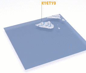 Places with similar names to Kyet Yo, Myanmar ::
// Kyetyo (MM)
Disclaimer :: Information on this page comes without warranty of any kind |
||
|
Where is Kyet Yo? Elevation and coordinates ::
Latitude (lat): 18°53'0"N Longitude (lon): 93°37'0"E
Elevation (approx.): 6m (map arrows pan, magnifying glasses zoom) |
||
|
Visiting Kyet Yo? Hotel/Accommodation ::
Book a hotel in Kyet Yo Travel Guide ::
Buy a travel guide for Myanmar rental cars ::
car rental offers GPS waypoint ::
download a GPX waypoint (PoI) of Kyet Yo for your GPS receiver
|
||