|
search place name
|
||
Kyuzaung (Myanmar)Kyuzaung is a town in Myanmar. An overview map of the region around Kyuzaung is displayed below.
regional and 3d topo map of Kyuzaung, Myanmar ::

Kyuzaung airports ::
The nearest airport is HEH - Heho, located 197.9 km north of Kyuzaung.
Nearby towns ::
Alemyaung (1.9km south) //
Pathichaung (2.6km south west) //
Kayinnigon (2.6km north west) //
Indainggon (2.6km south east) //
Padaukkon (2.6km north east) //
Kyapingale (2.6km north east) //
Inwaing (3.7km south) //
Kyundaw (4.0km north west) //
Kanni (4.1km north west) //
Yezingon (4.0km south east) //
Pyinmabin (4.0km north east) //
Nyaungbintha (5.1km south west) //
Thapanbin (5.3km west) //
Kyungyi (5.3km west) //
Zibyubin (5.3km west) //
Chaunggan (5.6km west) //
Shwele-in (5.6km west) //
Mogaung (5.8km south) //
Padetmyaung (5.8km south) //
Aingzauk (5.6km west) //
Reinnebin (5.8km north) //
Kachaung (6.6km south west) //
Ngwedaunggale (6.4km north east) //
Kyauktaing (6.4km north east) //
Tabyegyi (7.0km east) //
Paunglaungdin (7.6km south) //
Legyawdin (7.3km west) //
Pyasakan (7.3km east) //
Sinywa Anauk (7.7km north west) //
[all distances 'as the bird flies' and approximate] 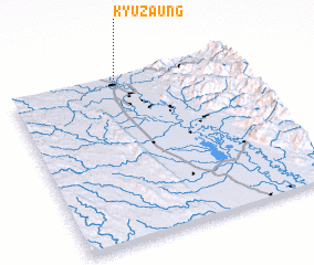 Places with similar names to Kyuzaung, Myanmar ::
Disclaimer :: Information on this page comes without warranty of any kind |
||
|
Where is Kyuzaung? Elevation and coordinates ::
Latitude (lat): 18°59'0"N Longitude (lon): 96°29'0"E
Elevation (approx.): 53m (map arrows pan, magnifying glasses zoom) |
||
|
Visiting Kyuzaung? Hotel/Accommodation ::
Book a hotel in Kyuzaung Travel Guide ::
Buy a travel guide for Myanmar rental cars ::
car rental offers GPS waypoint ::
download a GPX waypoint (PoI) of Kyuzaung for your GPS receiver
|
||