|
search place name
|
||
Lapalun (Shan, Myanmar)Lapalun is a town in the Shan region of Myanmar. An overview map of the region around Lapalun is displayed below.
regional and 3d topo map of Lapalun, Myanmar ::

Lapalun airports ::
The nearest airport is HEH - Heho, located 119.4 km north of Lapalun.
Nearby towns ::
Lapanwe (3.5km west) //
Lakinwe (4.0km north west) //
Lakilon (4.1km north west) //
Kawnla (5.1km south east) //
Kumatu Banpalan (5.6km south) //
Hklawpang (5.6km east) //
Kawnghsawng (6.6km north east) //
Kyala (7.6km south) //
Pikan (7.2km west) //
Sinkhun (7.2km west) //
Wān Loi-hsa-tūn (7.2km east) //
La-kyi-nampai (7.6km north east) //
Lweyaing (7.6km north west) //
Pikan (7.9km south west) //
Hki-hsawngla (8.2km south east) //
Loi-sang (8.2km north west) //
Hklawpenghko (7.9km south east) //
Hai-pek (7.9km north east) //
Hpe-hso-daw (9.1km south east) //
Ma-hsa-ra (9.1km south east) //
Loi-yein (8.9km south west) //
Wān Hsa-tè (9.1km north east) //
Lè-ba-htang (8.9km south east) //
Daw Kawlö (8.9km south east) //
[all distances 'as the bird flies' and approximate] 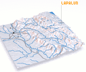 Places with similar names to Lapalun, Myanmar ::
// La Plaine (CH)
// La Polonia (PA)
// La Polonia (PA)
// Lipliūnai (LT)
// Lepplaane (EE)
// La Paulina (CU)
// La Pelona (CU)
// La Plana (ES)
// Lepilin (RU)
// La Pailona (CO)
Disclaimer :: Information on this page comes without warranty of any kind |
||
|
Where is Lapalun? Elevation and coordinates ::
Latitude (lat): 19°41'0"N Longitude (lon): 96°59'0"E
Elevation (approx.): 1189m (map arrows pan, magnifying glasses zoom) |
||
|
Visiting Lapalun? Hotel/Accommodation ::
Book a hotel in Lapalun Travel Guide ::
Buy a travel guide for Myanmar rental cars ::
car rental offers GPS waypoint ::
download a GPX waypoint (PoI) of Lapalun for your GPS receiver
|
||