|
search place name
|
||
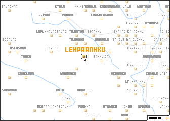
Le-hpa-anhku (Kayah, Myanmar)Le-hpa-anhku is a town in the Kayah region of Myanmar. An overview map of the region around Le-hpa-anhku is displayed below.
regional and 3d topo map of Le-hpa-anhku, Myanmar ::
Le-hpa-anhku airports ::
The nearest airport is HEH - Heho, located 138.2 km north of Le-hpa-anhku.
Nearby towns ::
Pi-tha-aw (2.5km south west) //
Ta-hkli-daw (3.5km east) //
Ta-ni-dawla (3.5km east) //
We-ban-hku (3.7km north) //
Tilawhsu (4.1km north west) //
Ma-hsè-la (5.1km north east) //
Dawrahku (5.1km south west) //
Daw Ta-wè (5.6km east) //
We-ban-hku (5.8km north) //
Tilawthu (5.8km north) //
Dawpè-hku (7.4km south) //
Lobahku (7.2km west) //
Lopu (7.6km north west) //
Ta-mö-lè (7.9km north east) //
Hko-ri-hku (7.9km south east) //
Dawkle-te (8.9km south east) //
Ta-yè-bi-hku (8.9km south east) //
Me-hawng (8.9km north east) //
Bato (9.1km south west) //
Lopu-hkaung-saung (8.9km north west) //
Wān Loi-nanghpa (10.2km north east) //
[all distances 'as the bird flies' and approximate] 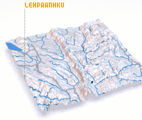 Places with similar names to Le-hpa-anhku, Myanmar ::
Disclaimer :: Information on this page comes without warranty of any kind |
||
|
Where is Le-hpa-anhku? Elevation and coordinates ::
Latitude (lat): 19°31'0"N Longitude (lon): 97°1'0"E
Elevation (approx.): 1368m (map arrows pan, magnifying glasses zoom) |
||
|
Visiting Le-hpa-anhku? Hotel/Accommodation ::
Book a hotel in Le-hpa-anhku Travel Guide ::
Buy a travel guide for Myanmar rental cars ::
car rental offers GPS waypoint ::
download a GPX waypoint (PoI) of Le-hpa-anhku for your GPS receiver
|
||