|
search place name
|
||
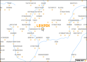
Leikpok (Sagaing, Myanmar)Leikpok is a town in the Sagaing region of Myanmar. An overview map of the region around Leikpok is displayed below.
regional and 3d topo map of Leikpok, Myanmar ::
Leikpok airports ::
The nearest airport is IMF - Imphal, located 175.6 km north west of Leikpok.
Nearby towns ::
Ka-nyingon (2.5km north west) //
Gwedaukkyin (3.4km west) //
Wunbe-in (4.1km south west) //
Migyaung-in (3.9km north west) //
Kani (4.1km south east) //
Padeingon (4.1km north east) //
Naunghmu (5.0km south west) //
Thazi (5.0km north west) //
Gwegyo (5.0km north east) //
Kinban (5.8km north) //
Thinbaunggyin (5.4km west) //
Hmangin (5.4km west) //
Kyauktaga (5.4km east) //
Onbyin (6.3km south west) //
Pazin-gôn (6.5km north west) //
Ingyi-let (6.5km north west) //
Kyettapha (6.3km north east) //
Kangôn Ngapaukkyin (7.4km north) //
Sa-ngan (7.6km south) //
Theinzin (7.0km east) //
Taungbi (7.6km north) //
Yintha (7.6km north) //
Auk Sinkwe (7.0km west) //
Taungni (7.6km north) //
Inga (7.5km south east) //
Gyogyawin (8.2km south west) //
Atet-Sinkwe (7.7km north west) //
Koyauk-legyibyin (8.2km north west) //
Nyaunggon (8.8km north west) //
[all distances 'as the bird flies' and approximate] 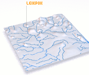 Places with similar names to Leikpok, Myanmar ::
Disclaimer :: Information on this page comes without warranty of any kind |
||
|
Where is Leikpok? Elevation and coordinates ::
Latitude (lat): 23°54'0"N Longitude (lon): 95°21'0"E
Elevation (approx.): 262m (map arrows pan, magnifying glasses zoom) |
||
|
Visiting Leikpok? Hotel/Accommodation ::
Book a hotel in Leikpok Travel Guide ::
Buy a travel guide for Myanmar rental cars ::
car rental offers GPS waypoint ::
download a GPX waypoint (PoI) of Leikpok for your GPS receiver
|
||