|
search place name
|
||
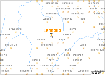
Leng Aka (Shan, Myanmar)Leng Aka is a town in the Shan region of Myanmar. An overview map of the region around Leng Aka is displayed below.
regional and 3d topo map of Leng Aka, Myanmar ::
Leng Aka airports ::
The nearest airport is HEH - Heho, located 80.4 km south west of Leng Aka.
Other airports nearby include MDL - Mandalay Intl (150.8 km west), LSH - Lashio (195.8 km north), MOG - Mong Hsat (214.4 km east), Nearby towns ::
Hwè Kot (1.9km south) //
Wān Tan (2.5km north west) //
Pang Yam (2.5km south east) //
Hpak Hkyem (4.1km south west) //
Wān Ngai (3.9km south west) //
Wān Kan (3.9km south east) //
Lak Hkai (5.2km east) //
Loi-hsam (5.8km north) //
Nawng Hsong (5.8km south) //
Wān Long Hsa La (6.4km south west) //
Mak Mo (7.4km south) //
Wān Kyawng (7.4km north) //
Kong Möng (7.4km south) //
Wān Ta Mai (7.6km south) //
Hoheng (7.2km east) //
Nā-wing (7.6km south) //
Hwè-hio (7.6km south east) //
Tan Hping (7.6km north east) //
Pa-hka (9.0km south east) //
Wān Hsam Kang (9.0km south east) //
[all distances 'as the bird flies' and approximate]  Places with similar names to Leng Aka, Myanmar ::
Disclaimer :: Information on this page comes without warranty of any kind |
||
|
Where is Leng Aka? Elevation and coordinates ::
Latitude (lat): 21°15'0"N Longitude (lon): 97°21'0"E
Elevation (approx.): 1341m (map arrows pan, magnifying glasses zoom) |
||
|
Visiting Leng Aka? Hotel/Accommodation ::
Book a hotel in Leng Aka Travel Guide ::
Buy a travel guide for Myanmar rental cars ::
car rental offers GPS waypoint ::
download a GPX waypoint (PoI) of Leng Aka for your GPS receiver
|
||