|
search place name
|
||
Lenti (Shan, Myanmar)Lenti is a town in the Shan region of Myanmar. An overview map of the region around Lenti is displayed below.
regional and 3d topo map of Lenti, Myanmar ::

Lenti airports ::
The nearest airport is LSH - Lashio, located 64.2 km north of Lenti.
Other airports nearby include MDL - Mandalay Intl (203.3 km west), HEH - Heho (210.7 km south west), KET - Kengtung (225.4 km south east), MOG - Mong Hsat (257.4 km south east), Nearby towns ::
Nam-hawn (2.5km south east) //
Hko-hkan (4.1km north west) //
Mān Maü (3.9km north east) //
Loi-ywoi (5.0km south east) //
Hko-hak (5.0km south east) //
Hsengkiao (5.1km west) //
Namhu-hpa-lang (5.5km east) //
Mān Yawn (5.5km east) //
Longkeng (5.8km north) //
Na-hsai (5.8km north) //
Ho-hkai (6.3km south west) //
Ho-tu (6.5km north east) //
Mān-kau-lōng (6.5km north east) //
Kongmong (6.9km east) //
Kong-kāt (7.1km west) //
Nam-hu (7.1km east) //
Kat-kom (7.8km south west) //
Na-si-ri (7.8km north east) //
Kawngkang (7.8km north west) //
Nawngheng (9.0km south west) //
Hpanghpai (8.8km north east) //
Hkamhseng (8.8km north west) //
Nawngteng (9.0km north east) //
Nammawhsom (10.1km south east) //
Nampen (10.1km north east) //
[all distances 'as the bird flies' and approximate] 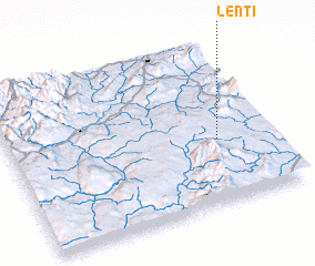 Places with similar names to Lenti, Myanmar ::
Disclaimer :: Information on this page comes without warranty of any kind |
||
|
Where is Lenti? Elevation and coordinates ::
Latitude (lat): 22°24'0"N Longitude (lon): 97°48'0"E
Elevation (approx.): 917m (map arrows pan, magnifying glasses zoom) |
||
|
Visiting Lenti? Hotel/Accommodation ::
Book a hotel in Lenti Travel Guide ::
Buy a travel guide for Myanmar rental cars ::
car rental offers GPS waypoint ::
download a GPX waypoint (PoI) of Lenti for your GPS receiver
|
||