|
search place name
|
||
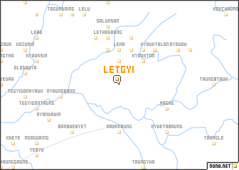
Letgyi (Myanmar)Letgyi is a town in Myanmar. An overview map of the region around Letgyi is displayed below.
regional and 3d topo map of Letgyi, Myanmar ::
Letgyi airports ::
The nearest airport is SNW - Thandwe, located 143.2 km south west of Letgyi.
Other airports nearby include HEH - Heho (236.2 km north east), Nearby towns ::
Padaukkyaw (3.7km north) //
Kyauktan (5.1km north east) //
Lema (5.6km north) //
Bwepinkwin (5.8km north) //
Ganeikkon (5.8km north) //
Wayonbinlè (6.6km north east) //
Paukkaung (7.4km south) //
Lethadaung (7.6km north) //
Pèmasin (7.6km north) //
Kyauktalon (7.7km north east) //
Kawma (8.2km north west) //
Magwe (7.9km south east) //
Kywetabaung (10.2km south east) //
Banbwebyet (10.2km south west) //
[all distances 'as the bird flies' and approximate] 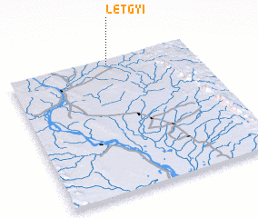 Places with similar names to Letgyi, Myanmar ::
Disclaimer :: Information on this page comes without warranty of any kind |
||
|
Where is Letgyi? Elevation and coordinates ::
Latitude (lat): 18°58'0"N Longitude (lon): 95°33'0"E
Elevation (approx.): 70m (map arrows pan, magnifying glasses zoom) |
||
|
Visiting Letgyi? Hotel/Accommodation ::
Book a hotel in Letgyi Travel Guide ::
Buy a travel guide for Myanmar rental cars ::
car rental offers GPS waypoint ::
download a GPX waypoint (PoI) of Letgyi for your GPS receiver
|
||