|
search place name
|
||
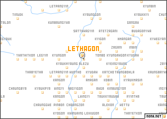
Lethagon (Sagaing, Myanmar)Lethagon is a town in the Sagaing region of Myanmar. An overview map of the region around Lethagon is displayed below.
regional and 3d topo map of Lethagon, Myanmar ::
Lethagon airports ::
The nearest airport is IMF - Imphal, located 204.6 km north west of Lethagon.
Other airports nearby include MYT - Myitkyina (231.9 km north east), Nearby towns ::
Chiyagon (0.0km north) //
Auk Namaw (0.0km north) //
Namalin (0.0km north) //
Wabo-gyaung (0.0km north) //
Alezu (1.9km south) //
Aung-gon (1.9km south) //
Mogyin (1.9km north) //
Le-u (1.9km north) //
Tonbo (3.4km east) //
Tongyeik (3.4km east) //
Kyauk-taing (3.7km south) //
Kyauk-myaung (3.9km south west) //
Alegyun (3.9km north east) //
In-ma-ywa (3.9km north east) //
Kyeingyaung (3.9km north east) //
Metkalet (4.1km south east) //
Kyudaw (4.1km south east) //
Wuntho (4.1km south west) //
Ywathitkôn (4.1km south west) //
Auktaw (4.1km south east) //
Seinzu (3.9km north west) //
Kaukkwe (5.0km south east) //
Didokkon-ywa (5.0km south west) //
Kyigon (5.0km north east) //
Kyungon (5.1km west) //
Satthwagyin (5.6km north) //
Ngwe-na (5.6km north) //
Nga-yan-gyaung (5.8km south) //
A-magan (5.8km south) //
[all distances 'as the bird flies' and approximate]  Places with similar names to Lethagon, Myanmar ::
Disclaimer :: Information on this page comes without warranty of any kind |
||
|
Where is Lethagon? Elevation and coordinates ::
Latitude (lat): 23°56'0"N Longitude (lon): 95°42'0"E
Elevation (approx.): 216m (map arrows pan, magnifying glasses zoom) |
||
|
Visiting Lethagon? Hotel/Accommodation ::
Book a hotel in Lethagon Travel Guide ::
Buy a travel guide for Myanmar rental cars ::
car rental offers GPS waypoint ::
download a GPX waypoint (PoI) of Lethagon for your GPS receiver
|
||