|
search place name
|
||
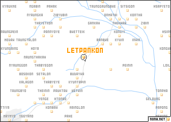
Let-pan-kon (Shan, Myanmar)Let-pan-kon is a town in the Shan region of Myanmar. An overview map of the region around Let-pan-kon is displayed below.
regional and 3d topo map of Let-pan-kon, Myanmar ::
Let-pan-kon airports ::
The nearest airport is MDL - Mandalay Intl, located 82.5 km south west of Let-pan-kon.
Other airports nearby include LSH - Lashio (148.5 km north east), HEH - Heho (156.4 km south), Nearby towns ::
Kyin-ga-naing (1.9km north) //
Nam-lin-khan (2.5km south west) //
Bu-da-ywa (4.1km south west) //
Banbwe (5.1km north east) //
Nyaung-dauk-ywama (5.5km east) //
Kyun-ta-pin (5.8km south) //
Bwetteik (5.8km north) //
Nyaung-gon (6.3km north east) //
Gan-kaw (7.6km north) //
Wetwin (7.6km south) //
Mi-thwe-bo (7.6km south west) //
Kyu-in (7.8km north east) //
Kon-gyi (8.8km north east) //
Tha-bye-ye (8.8km south west) //
Pauk-taw (9.0km south west) //
Pan-nyo-ye (8.8km north west) //
Zati Kala-ywa (9.0km north west) //
The-khaw (10.1km north east) //
[all distances 'as the bird flies' and approximate] 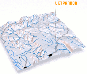 Places with similar names to Let-pan-kon, Myanmar ::
Disclaimer :: Information on this page comes without warranty of any kind |
||
|
Where is Let-pan-kon? Elevation and coordinates ::
Latitude (lat): 22°9'0"N Longitude (lon): 96°37'0"E
Elevation (approx.): 877m (map arrows pan, magnifying glasses zoom) |
||
|
Visiting Let-pan-kon? Hotel/Accommodation ::
Book a hotel in Let-pan-kon Travel Guide ::
Buy a travel guide for Myanmar rental cars ::
car rental offers GPS waypoint ::
download a GPX waypoint (PoI) of Let-pan-kon for your GPS receiver
|
||