|
search place name
|
||
Loi-pek (Shan, Myanmar)Loi-pek is a town in the Shan region of Myanmar. An overview map of the region around Loi-pek is displayed below.
regional and 3d topo map of Loi-pek, Myanmar ::

Loi-pek airports ::
The nearest airport is LSH - Lashio, located 70.4 km south west of Loi-pek.
Nearby towns ::
Ho-pang (1.7km west) //
Nawnghkio (1.7km east) //
Mānkao-poktao (1.9km south) //
Ho-hsa (3.7km south) //
Loi-sawng (4.1km north west) //
Panghkam (4.1km north west) //
Ho-tu Mān Kang (3.9km north west) //
Kawnghkam (3.9km north east) //
Panghpa-mawng (4.1km south west) //
Namhkomhkam (4.1km south east) //
Loi-hkam (5.1km west) //
Ponghtang (5.4km east) //
Panghpakmöng (5.8km south) //
Kongtap (5.8km north) //
Ho-tu (6.3km north west) //
Na-ti (6.5km north east) //
Pangpu (6.3km south west) //
Ma-nao (6.8km east) //
Ho-hsö (7.6km north) //
Kongsong (7.6km north) //
Nam-ye (7.1km east) //
Pangkaw (7.1km east) //
Pangwa (7.5km north east) //
Pangti (7.5km north west) //
Hsengkiao (7.8km north west) //
Hkunniu (8.8km north west) //
Loi-hseng (9.0km south west) //
Ho-pong (10.1km south east) //
[all distances 'as the bird flies' and approximate] 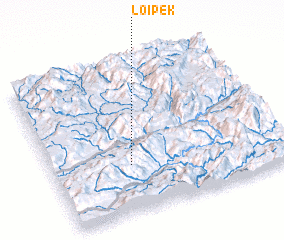 Places with similar names to Loi-pek, Myanmar ::
Disclaimer :: Information on this page comes without warranty of any kind |
||
|
Where is Loi-pek? Elevation and coordinates ::
Latitude (lat): 23°19'0"N Longitude (lon): 98°20'0"E
Elevation (approx.): 1217m (map arrows pan, magnifying glasses zoom) |
||
|
Visiting Loi-pek? Hotel/Accommodation ::
Book a hotel in Loi-pek Travel Guide ::
Buy a travel guide for Myanmar rental cars ::
car rental offers GPS waypoint ::
download a GPX waypoint (PoI) of Loi-pek for your GPS receiver
|
||