|
search place name
|
||
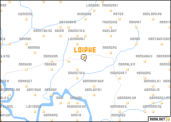
Loi-pwe (Shan, Myanmar)Loi-pwe is a town in the Shan region of Myanmar. An overview map of the region around Loi-pwe is displayed below.
regional and 3d topo map of Loi-pwe, Myanmar ::
Loi-pwe airports ::
The nearest airport is LSH - Lashio, located 119.6 km north west of Loi-pwe.
Other airports nearby include KET - Kengtung (158.8 km south east), MOG - Mong Hsat (194.2 km south east), HEH - Heho (212.8 km south west), THL - Tachilek Tachileik (240.1 km south east), Nearby towns ::
Mān Kyawng (2.5km south west) //
Mān Kawngmu (3.4km west) //
Nawngtaw (4.1km south west) //
Loi Na Hpai (4.1km north west) //
Na-hok (5.6km north) //
Wān Nampawn (5.8km south) //
Möng Awt (5.5km east) //
Nawngpu (5.5km east) //
Nawngyau (5.8km north) //
Namhkan (6.9km west) //
Wān Loi-yai (7.6km south) //
Namhak (7.1km west) //
Hai-pa (7.6km north west) //
Hwe-lawt (7.6km north east) //
Nawngpat (7.8km south east) //
Hathka-ha (8.2km north west) //
Tawnghio (9.0km north east) //
Tungkwang (9.0km north west) //
Hpa-pok (10.1km south west) //
Nawngkim (10.1km south west) //
[all distances 'as the bird flies' and approximate] 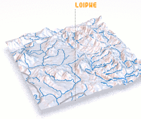 Places with similar names to Loi-pwe, Myanmar ::
Disclaimer :: Information on this page comes without warranty of any kind |
||
|
Where is Loi-pwe? Elevation and coordinates ::
Latitude (lat): 22°2'0"N Longitude (lon): 98°19'0"E
Elevation (approx.): 894m (map arrows pan, magnifying glasses zoom) |
||
|
Visiting Loi-pwe? Hotel/Accommodation ::
Book a hotel in Loi-pwe Travel Guide ::
Buy a travel guide for Myanmar rental cars ::
car rental offers GPS waypoint ::
download a GPX waypoint (PoI) of Loi-pwe for your GPS receiver
|
||