|
search place name
|
||
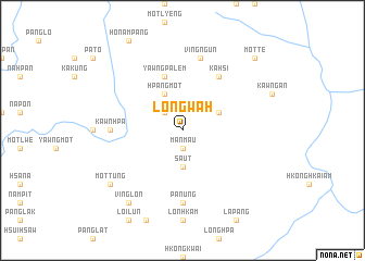
Longwah (Shan, Myanmar)Longwah is a town in the Shan region of Myanmar. An overview map of the region around Longwah is displayed below.
regional and 3d topo map of Longwah, Myanmar ::
Longwah airports ::
The nearest airport is KET - Kengtung, located 143.9 km south of Longwah.
Other airports nearby include LSH - Lashio (161.0 km west), Nearby towns ::
Mānmau (1.9km south) //
Yawngpalawng (2.5km north west) //
Sa-ut (3.7km south) //
Htonawng (3.9km north east) //
Hpangmot (4.1km north west) //
Yawngpalem (5.8km north) //
Kahsi (6.5km north east) //
Kawnhpa (6.8km west) //
Panung (7.4km south) //
Ving Ngün (7.6km north) //
Ving Lön (9.0km south west) //
Mottung (8.8km south west) //
Motte (10.1km north east) //
[all distances 'as the bird flies' and approximate] 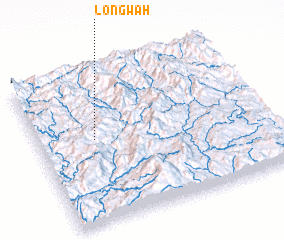 Places with similar names to Longwah, Myanmar ::
Disclaimer :: Information on this page comes without warranty of any kind |
||
|
Where is Longwah? Elevation and coordinates ::
Latitude (lat): 22°33'0"N Longitude (lon): 99°15'0"E
Elevation (approx.): 1144m (map arrows pan, magnifying glasses zoom) |
||
|
Visiting Longwah? Hotel/Accommodation ::
Book a hotel in Longwah Travel Guide ::
Buy a travel guide for Myanmar rental cars ::
car rental offers GPS waypoint ::
download a GPX waypoint (PoI) of Longwah for your GPS receiver
|
||