|
search place name
|
||
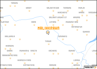
Malihkrawn (Kachin State, Myanmar)Malihkrawn is a town in the Kachin State region of Myanmar. An overview map of the region around Malihkrawn is displayed below.
regional and 3d topo map of Malihkrawn, Myanmar ::
Malihkrawn airports ::
The nearest airport is MYT - Myitkyina, located 45.8 km south west of Malihkrawn.
Other airports nearby include PBU - Putao (188.1 km north), Nearby towns ::
Tingum (3.7km south) //
Mahtē (3.7km south) //
Layang (4.1km north east) //
Tunkawng (5.3km east) //
Salaw 'Ntunghkyet (6.5km north east) //
Maliyang (6.2km north east) //
Mara (6.2km north west) //
Kācheng (7.6km south) //
Pumrawng (7.6km north) //
Graugra (8.1km south east) //
Ningta (8.9km south west) //
Hkacheng (8.9km north east) //
[all distances 'as the bird flies' and approximate]  Places with similar names to Malihkrawn, Myanmar ::
// Mühlgrün (DE)
// Molíkrion (GR)
// Małe Krówno (PL)
// Melikören (TR)
// Mill Green (US)
// Mill Green (US)
// Malqaranī (IR)
// Malagrān (PK)
// Malik Arāīn (PK)
// Malicornay (FR)
Disclaimer :: Information on this page comes without warranty of any kind |
||
|
Where is Malihkrawn? Elevation and coordinates ::
Latitude (lat): 25°39'0"N Longitude (lon): 97°42'0"E
Elevation (approx.): 531m (map arrows pan, magnifying glasses zoom) |
||
|
Visiting Malihkrawn? Hotel/Accommodation ::
Book a hotel in Malihkrawn Travel Guide ::
Buy a travel guide for Myanmar rental cars ::
car rental offers GPS waypoint ::
download a GPX waypoint (PoI) of Malihkrawn for your GPS receiver
|
||