|
search place name
|
||
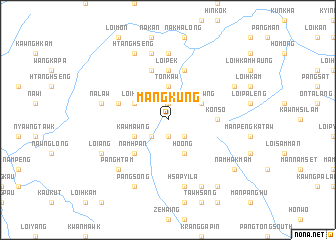
Mangkung (Shan, Myanmar)Mangkung is a town in the Shan region of Myanmar. An overview map of the region around Mangkung is displayed below.
regional and 3d topo map of Mangkung, Myanmar ::
Mangkung airports ::
The nearest airport is LSH - Lashio, located 102.1 km east of Mangkung.
Other airports nearby include MDL - Mandalay Intl (150.9 km south west), Nearby towns ::
Höhkö (1.9km north) //
Sèkwang (1.9km south) //
Mántali (1.9km south) //
Namawtawng (2.5km south east) //
Tàyi (2.5km south west) //
Tönkaw (3.7km north) //
Ho-ong (4.1km south east) //
Haitawng (3.9km north east) //
Loihsa (3.9km north west) //
Kawmawng (3.9km south west) //
Namhpan (5.0km south west) //
Loipek (5.6km north) //
Konso (5.1km east) //
Tawkut (5.8km north) //
Hona (5.4km west) //
Manmong (5.8km north) //
Hpàtang (7.4km north) //
Hsapyila (7.6km south) //
Nalaw (7.1km west) //
Pángmöng (7.6km north) //
Pánghtam (7.6km south west) //
Mánpángtarap (7.8km north east) //
Pàngpau (7.8km north east) //
Loi-ang (7.8km south west) //
Páhká (8.2km south east) //
Htānghseng (8.2km north west) //
Mönglaw (8.2km north west) //
Pángsong (8.2km south west) //
Namhakmàm (8.8km south east) //
[all distances 'as the bird flies' and approximate] 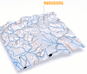 Places with similar names to Mangkung, Myanmar ::
// Maingkaing (MM)
// Mān Ke-hkang (MM)
// Mān Kiu-hkawng (MM)
// Meng Kong (MM)
// Möngkawng (MM)
// Möng Keng (MM)
// Möng Küng (MM)
// Möng Kang (MM)
// Möng Kang (MM)
// Möng Kawng (MM)
Disclaimer :: Information on this page comes without warranty of any kind |
||
|
Where is Mangkung? Elevation and coordinates ::
Latitude (lat): 22°51'0"N Longitude (lon): 96°46'0"E
Elevation (approx.): 953m (map arrows pan, magnifying glasses zoom) |
||
|
Visiting Mangkung? Hotel/Accommodation ::
Book a hotel in Mangkung Travel Guide ::
Buy a travel guide for Myanmar rental cars ::
car rental offers GPS waypoint ::
download a GPX waypoint (PoI) of Mangkung for your GPS receiver
|
||