|
search place name
|
||
Mān Hsiao-hten (Shan, Myanmar)Mān Hsiao-hten is a town in the Shan region of Myanmar. An overview map of the region around Mān Hsiao-hten is displayed below.
regional and 3d topo map of Mān Hsiao-hten, Myanmar ::

Mān Hsiao-hten airports ::
The nearest airport is LSH - Lashio, located 99.8 km south west of Mān Hsiao-hten.
Other airports nearby include MYT - Myitkyina (239.0 km north west), Nearby towns ::
Mān Pangsung (1.9km north) //
Mān Kawnghkam (1.9km north) //
Mān Pinghpang (1.9km south) //
Mān Nawnghkiu (2.5km north east) //
Mān Kawnghsung (3.4km west) //
Mān Namhsam (3.7km north) //
Mān Loi-hpwi (3.7km south) //
Mān Nampa-mung (3.4km east) //
Mān Mao (5.0km north west) //
Möng Paw (5.0km north west) //
Mān Lao-kao (5.0km north east) //
Mān Hō-hpa (5.1km west) //
Mān Namhkan (5.6km south) //
Wān Chu-ang (5.4km east) //
Mān Kawng-et (6.5km south east) //
Mān Ko-kai-htang (6.5km north east) //
Mān Kawngkaw (7.4km north) //
Mān Ma-ha-pangku (7.4km south) //
Mān Makkawk (7.0km west) //
Mān Pūntu (7.0km west) //
Mān Heng (7.6km north) //
Mān Lunghtang (7.0km east) //
Mān Su-hsu (7.7km south west) //
Mān Pangpōk (7.7km north east) //
Mān Hoi (9.0km north east) //
Mān Hsiao-ma-ti (9.0km south east) //
Wān Hkawngkawshu (10.1km north east) //
[all distances 'as the bird flies' and approximate] 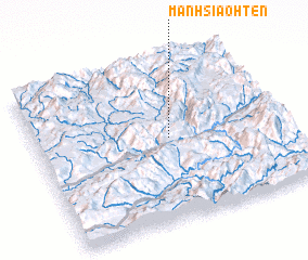 Places with similar names to Mān Hsiao-hten, Myanmar ::
// Manshuitan (CN)
Disclaimer :: Information on this page comes without warranty of any kind |
||
|
Where is Mān Hsiao-hten? Elevation and coordinates ::
Latitude (lat): 23°31'0"N Longitude (lon): 98°32'0"E
Elevation (approx.): 1498m (map arrows pan, magnifying glasses zoom) |
||
|
Visiting Mān Hsiao-hten? Hotel/Accommodation ::
Book a hotel in Mān Hsiao-hten Travel Guide ::
Buy a travel guide for Myanmar rental cars ::
car rental offers GPS waypoint ::
download a GPX waypoint (PoI) of Mān Hsiao-hten for your GPS receiver
|
||