|
search place name
|
||
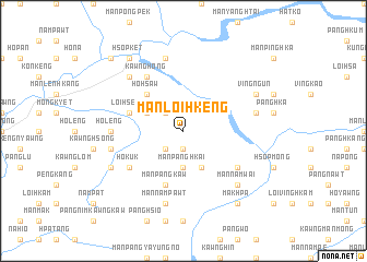
Mān Loi-hkeng (Shan, Myanmar)Mān Loi-hkeng is a town in the Shan region of Myanmar. An overview map of the region around Mān Loi-hkeng is displayed below.
regional and 3d topo map of Mān Loi-hkeng, Myanmar ::
Mān Loi-hkeng airports ::
The nearest airport is LSH - Lashio, located 76.5 km west of Mān Loi-hkeng.
Other airports nearby include KET - Kengtung (233.5 km south east), Nearby towns ::
Mān Pānghpa (1.9km south) //
Mān Pūngtung (2.5km north west) //
Mān Pangkan (2.5km south west) //
Mān Panghkai (3.7km south) //
Pongtong (3.9km north west) //
Mān Kawnghung (4.1km south east) //
Ho-hsaw (5.0km north west) //
Pāngpu (5.4km west) //
Loi-hseng (5.4km west) //
Mān Pangkaw (5.8km south) //
Mān Lao-yi (5.8km south) //
Kawnghong (6.5km north west) //
Ho-kuk (6.3km south west) //
Mān Kawngning (6.3km south east) //
Ho-leng (6.8km west) //
Mān Kawnghsa (7.6km north) //
Nawnghsampu (7.1km west) //
Mān Nampawt (7.6km south) //
Mān Wok (7.1km east) //
Mān Namwai (7.6km south east) //
Na-peng (7.6km north west) //
Mān Kawnghsung (7.6km south east) //
Kawnghsang (7.8km south west) //
Vingngün (7.8km north east) //
Mān Kang (7.8km north east) //
Hsopket (9.0km north west) //
Makhpa (9.0km south east) //
Mān Namlet (10.1km north west) //
[all distances 'as the bird flies' and approximate] 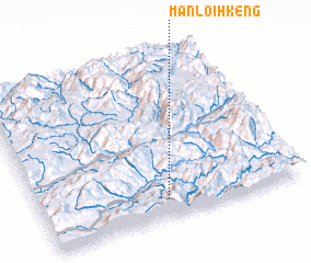 Places with similar names to Mān Loi-hkeng, Myanmar ::
// Mān Loi-kang (MM)
// Mān Loi-kang (MM)
Disclaimer :: Information on this page comes without warranty of any kind |
||
|
Where is Mān Loi-hkeng? Elevation and coordinates ::
Latitude (lat): 23°7'0"N Longitude (lon): 98°29'0"E
Elevation (approx.): 1131m (map arrows pan, magnifying glasses zoom) |
||
|
Visiting Mān Loi-hkeng? Hotel/Accommodation ::
Book a hotel in Mān Loi-hkeng Travel Guide ::
Buy a travel guide for Myanmar rental cars ::
car rental offers GPS waypoint ::
download a GPX waypoint (PoI) of Mān Loi-hkeng for your GPS receiver
|
||