|
search place name
|
||
Mawhta (Myanmar)Mawhta is a town in Myanmar. An overview map of the region around Mawhta is displayed below.
regional and 3d topo map of Mawhta, Myanmar ::

Mawhta airports ::
The nearest airport is RGN - Yangon Intl, located 131.1 km south west of Mawhta.
Nearby towns ::
Wingalon (1.9km north) //
Lebaw (1.9km south) //
Methana (2.6km south east) //
Htahtihta (3.7km north) //
Methaung (4.1km north east) //
Kyonwawwa (4.0km south east) //
Mèthaungwa (5.1km north west) //
Htitolo (5.1km south east) //
Kyongyaungbya (5.3km west) //
Thayetpingwa (5.3km east) //
Melaw-auk-ywa (5.8km north) //
Duyin (5.6km west) //
Melaw (7.4km north) //
Melaw-shan-ywa (7.4km north) //
Mèphaung Atet (7.1km east) //
Mèphaungwa (7.1km east) //
Melaw-ale-ywa (7.6km north) //
Melawkhi (7.6km north) //
Mèphaung-bya (7.3km east) //
Lawkwadaw (7.6km south) //
Mekadihta (7.3km east) //
Gyongyongya (7.7km north west) //
Kamawtaw (7.7km north west) //
U-bokchaungbya (7.7km north east) //
Htinyanahta (7.7km south east) //
Panbin-ywa (8.2km north east) //
Sawhti (8.2km south west) //
Methana (8.2km south east) //
Mothabyubya (9.1km south west) //
[all distances 'as the bird flies' and approximate] 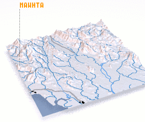 Places with similar names to Mawhta, Myanmar ::
Disclaimer :: Information on this page comes without warranty of any kind |
||
|
Where is Mawhta? Elevation and coordinates ::
Latitude (lat): 17°43'0"N Longitude (lon): 97°2'0"E
Elevation (approx.): 87m (map arrows pan, magnifying glasses zoom) |
||
|
Visiting Mawhta? Hotel/Accommodation ::
Book a hotel in Mawhta Travel Guide ::
Buy a travel guide for Myanmar rental cars ::
car rental offers GPS waypoint ::
download a GPX waypoint (PoI) of Mawhta for your GPS receiver
|
||