|
search place name
|
||
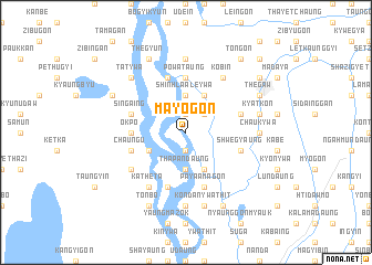
Mayogon (Mandalay, Myanmar)Mayogon is a town in the Mandalay region of Myanmar. An overview map of the region around Mayogon is displayed below.
regional and 3d topo map of Mayogon, Myanmar ::
Mayogon airports ::
The nearest airport is MDL - Mandalay Intl, located 51.8 km south of Mayogon.
Other airports nearby include HEH - Heho (175.8 km south east), LSH - Lashio (198.3 km north east), Nearby towns ::
Shinhla Taung (1.9km north) //
Hinthagon (1.9km north) //
Ngedo (1.9km south) //
Wehingama (2.5km north east) //
Shinhla Aleywa (3.7km north) //
Thapandaung (3.7km south) //
Pyinga (3.9km south west) //
Mayabin (4.1km north east) //
Shwebaung (4.1km south east) //
Okpo (5.1km west) //
Powa Taung (5.6km north) //
Singaing (5.5km west) //
Aingdaing (5.8km south) //
Mogyogyun (5.8km north) //
Taunggaing (5.5km east) //
Chaung-u (5.5km west) //
Paya-amagon (5.8km south) //
Shwegyaung (5.5km east) //
Myitkauk (5.5km east) //
Katheta (6.5km south west) //
Mezaligyaung (6.3km south west) //
Kobin (6.5km north east) //
Samungon (7.4km north) //
Kondan (7.4km south) //
Dingagyun (7.4km south) //
Chaukywa (6.9km east) //
Kyatkon (7.1km east) //
Kondanywathit (7.6km south) //
Tatywa (7.6km north west) //
[all distances 'as the bird flies' and approximate] 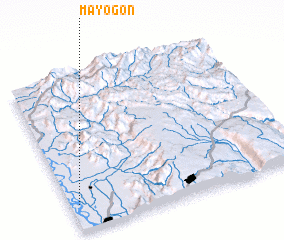 Places with similar names to Mayogon, Myanmar ::
Disclaimer :: Information on this page comes without warranty of any kind |
||
|
Where is Mayogon? Elevation and coordinates ::
Latitude (lat): 22°10'0"N Longitude (lon): 96°2'0"E
Elevation (approx.): 64m (map arrows pan, magnifying glasses zoom) |
||
|
Visiting Mayogon? Hotel/Accommodation ::
Book a hotel in Mayogon Travel Guide ::
Buy a travel guide for Myanmar rental cars ::
car rental offers GPS waypoint ::
download a GPX waypoint (PoI) of Mayogon for your GPS receiver
|
||