|
search place name
|
||
Melaw (Shan, Myanmar)Melaw is a town in the Shan region of Myanmar. An overview map of the region around Melaw is displayed below.
regional and 3d topo map of Melaw, Myanmar ::

Melaw airports ::
The nearest airport is HEH - Heho, located 40.4 km north west of Melaw.
Other airports nearby include MDL - Mandalay Intl (175.7 km north west), Nearby towns ::
Pangcho (1.9km north) //
Longhtawng (2.5km south east) //
Htiri (4.1km south east) //
Titan (4.1km north east) //
Loilek (3.9km north east) //
Nawnghkai (5.1km south east) //
Nampalok (5.1km south west) //
Hkwelu (5.2km east) //
Wetsagyaung (5.2km west) //
Magyibin (5.5km west) //
Thayetpin (5.5km west) //
Hkedaung (5.8km north) //
Kanainggyi (6.4km south west) //
Tāpūhto (6.6km north east) //
Hti-ri (6.4km north east) //
Hti-htāp (6.9km east) //
Kyawnghto (7.2km east) //
Lontep (7.6km north) //
Tawnghti (7.6km south) //
Dada-u (7.2km west) //
Hti-ne (8.2km south east) //
Longon (7.9km south west) //
Kunmaw (8.2km south west) //
Le-nge (8.2km north west) //
Pyadein (8.9km south west) //
Hsawnghpo (10.2km south east) //
Pankon (10.2km south west) //
[all distances 'as the bird flies' and approximate] 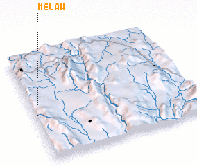 Places with similar names to Melaw, Myanmar ::
Disclaimer :: Information on this page comes without warranty of any kind |
||
|
Where is Melaw? Elevation and coordinates ::
Latitude (lat): 20°27'0"N Longitude (lon): 97°1'0"E
Elevation (approx.): 1591m (map arrows pan, magnifying glasses zoom) |
||
|
Visiting Melaw? Hotel/Accommodation ::
Book a hotel in Melaw Travel Guide ::
Buy a travel guide for Myanmar rental cars ::
car rental offers GPS waypoint ::
download a GPX waypoint (PoI) of Melaw for your GPS receiver
|
||