|
search place name
|
||
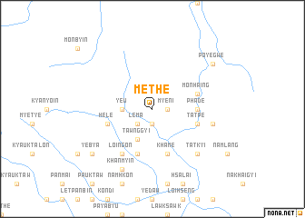
Methe (Shan, Myanmar)Methe is a town in the Shan region of Myanmar. An overview map of the region around Methe is displayed below.
regional and 3d topo map of Methe, Myanmar ::
Methe airports ::
The nearest airport is HEH - Heho, located 68.9 km south of Methe.
Other airports nearby include MDL - Mandalay Intl (97.7 km north west), LSH - Lashio (201.2 km north east), Nearby towns ::
Sindaung (1.9km south) //
Myeni (1.7km east) //
Lema (2.5km south west) //
Ye-u (3.5km west) //
Tawnggyi (4.1km south west) //
Phade (5.2km east) //
Monhaing (5.5km east) //
Hele (5.5km west) //
Ngabin (5.8km south) //
Khame (5.8km south) //
Ingwet (5.8km south) //
Tatpe (5.5km east) //
Ngapyawgaing (5.5km east) //
Loi-ngon (6.5km south west) //
Nanhu (7.1km east) //
Tatkyi (7.6km south east) //
Khanmyin (8.2km south west) //
Yebya (8.9km south west) //
Poyegwe (8.9km north east) //
[all distances 'as the bird flies' and approximate] 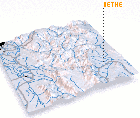 Places with similar names to Methe, Myanmar ::
Disclaimer :: Information on this page comes without warranty of any kind |
||
|
Where is Methe? Elevation and coordinates ::
Latitude (lat): 21°22'0"N Longitude (lon): 96°51'0"E
Elevation (approx.): 1039m (map arrows pan, magnifying glasses zoom) |
||
|
Visiting Methe? Hotel/Accommodation ::
Book a hotel in Methe Travel Guide ::
Buy a travel guide for Myanmar rental cars ::
car rental offers GPS waypoint ::
download a GPX waypoint (PoI) of Methe for your GPS receiver
|
||