|
search place name
|
||
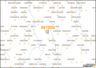
Me-yong (Shan, Myanmar)Me-yong is a town in the Shan region of Myanmar. An overview map of the region around Me-yong is displayed below.
regional and 3d topo map of Me-yong, Myanmar ::
Me-yong airports ::
The nearest airport is HEH - Heho, located 69.9 km west of Me-yong.
Other airports nearby include MDL - Mandalay Intl (173.3 km north west), MOG - Mong Hsat (195.5 km east), Nearby towns ::
Hsaihkan (1.9km south) //
Mān Ponglaw (1.9km north) //
Hwehkai (2.5km south east) //
Wān Ko-lang (2.5km south east) //
Kawngwū (3.5km east) //
Wān Pan (4.1km south east) //
Pa-hka (4.1km north east) //
Ho-na (3.9km north east) //
Pa-ling (5.1km south west) //
Hti-paeng (5.1km south west) //
Man Hko-ling (5.1km north west) //
Man-kup (5.2km west) //
Loi-weng (5.6km north) //
Wān Pan (5.8km south) //
Ho-to (5.5km west) //
Namme-kwi (5.5km west) //
Nā-ning (5.5km west) //
Wān Hwe (5.8km south) //
Si-hawngnawk (6.5km north west) //
Makmongtawp (6.5km south east) //
Ho-na (6.5km south east) //
Konmo (6.9km west) //
Hwe-hkum (6.9km east) //
Namsang (7.2km west) //
Hwè-liaw (7.6km south) //
Nawngwek (7.2km west) //
Naw-nya (7.2km west) //
Ho-na (7.6km south west) //
Panglem (7.6km north east) //
[all distances 'as the bird flies' and approximate]  Places with similar names to Me-yong, Myanmar ::
Disclaimer :: Information on this page comes without warranty of any kind |
||
|
Where is Me-yong? Elevation and coordinates ::
Latitude (lat): 20°56'0"N Longitude (lon): 97°26'0"E
Elevation (approx.): 1382m (map arrows pan, magnifying glasses zoom) |
||
|
Visiting Me-yong? Hotel/Accommodation ::
Book a hotel in Me-yong Travel Guide ::
Buy a travel guide for Myanmar rental cars ::
car rental offers GPS waypoint ::
download a GPX waypoint (PoI) of Me-yong for your GPS receiver
|
||