|
search place name
|
||
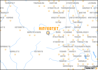
Minye-atet (Myanmar)Minye-atet is a town in Myanmar. An overview map of the region around Minye-atet is displayed below.
regional and 3d topo map of Minye-atet, Myanmar ::
Minye-atet airports ::
The nearest airport is RGN - Yangon Intl, located 199.7 km south of Minye-atet.
Nearby towns ::
Minye (1.8km east) //
Kyatpyin (2.6km north east) //
Sibin (2.6km north east) //
Thayettaw (3.5km east) //
Okpo (3.5km east) //
Myezi Myauk (4.0km south east) //
Myezi Taung (4.0km south east) //
Myezi (4.0km south east) //
Yeshan (4.0km north east) //
Gwedaukkhin (4.0km north east) //
Kywemathe (5.1km south east) //
Yetho (5.1km north east) //
Bongyi Chaung (5.3km west) //
Kyatkala (5.3km east) //
Swelegyaung (5.3km east) //
Tangon (5.6km east) //
Hngetpyawdaw (6.6km north east) //
Kogwa (6.4km south east) //
Kywebwe (7.0km east) //
Thapangyaung (7.0km west) //
Zayat (7.3km east) //
Ko Tani Tē (8.2km south west) //
Tingoktan (7.9km south east) //
Kyauktaing (7.9km south east) //
Kanhledaw (8.2km north east) //
Wetkon (8.2km north east) //
Milaunggon (8.2km north east) //
Shanzu (8.2km north east) //
Natyedwin (8.2km south east) //
[all distances 'as the bird flies' and approximate]  Places with similar names to Minye-atet, Myanmar ::
// Minyudadui (CN)
Disclaimer :: Information on this page comes without warranty of any kind |
||
|
Where is Minye-atet? Elevation and coordinates ::
Latitude (lat): 18°42'0"N Longitude (lon): 96°21'0"E
Elevation (approx.): 91m (map arrows pan, magnifying glasses zoom) |
||
|
Visiting Minye-atet? Hotel/Accommodation ::
Book a hotel in Minye-atet Travel Guide ::
Buy a travel guide for Myanmar rental cars ::
car rental offers GPS waypoint ::
download a GPX waypoint (PoI) of Minye-atet for your GPS receiver
|
||