|
search place name
|
||
Möng Hpen (Shan, Myanmar)Möng Hpen is a town in the Shan region of Myanmar. An overview map of the region around Möng Hpen is displayed below.
regional and 3d topo map of Möng Hpen, Myanmar ::

Möng Hpen airports ::
The nearest airport is KET - Kengtung, located 75.5 km south of Möng Hpen.
Other airports nearby include MOG - Mong Hsat (167.0 km south), THL - Tachilek Tachileik (169.0 km south), LSH - Lashio (222.7 km north west), Nearby towns ::
Wān Namwa (1.9km south) //
Wān Namlōm (1.7km west) //
Wān Na-lawn (1.9km north) //
Wān Htamkwang (2.5km south west) //
Wān Yanghkam (2.5km south east) //
Wān Hōkhin (2.5km south east) //
Wān Sānghpök (2.5km south east) //
Wān Bawhpa (2.5km north east) //
Wān Nawnghkēng (3.4km west) //
Wān Tāng (4.1km south east) //
Wān Hwè-hu (4.1km north west) //
Wān Nambaw (5.2km east) //
Wān Pungsong (5.8km north) //
Wān Bokhtrö (6.4km south west) //
Wān Bōkhsi-li (6.4km south west) //
Wān Ai-la (6.4km south east) //
Nam Bawtaw (6.5km south east) //
Wān Māngtam (6.5km south east) //
Wān Wanghkam (7.6km south) //
Wān Pa-pōk (7.6km south) //
Wān Ho-na-ho-ta (7.6km south) //
Wān Möngnoi (7.6km south west) //
Wān Hwè-mi (7.6km south west) //
Wān Möngnoi (7.8km south west) //
Wān Htamhpa-leng (8.2km south east) //
Wān Pangpok (8.2km north west) //
Wān Hwè-hin (8.2km north east) //
Wān Pa-ta (8.8km south east) //
[all distances 'as the bird flies' and approximate] 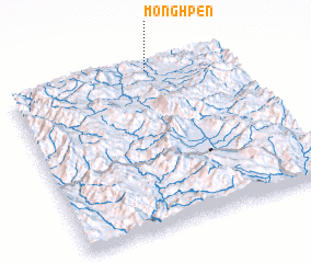 Places with similar names to Möng Hpen, Myanmar :: Disclaimer :: Information on this page comes without warranty of any kind |
||
|
Where is Möng Hpen? Elevation and coordinates ::
Latitude (lat): 21°59'0"N Longitude (lon): 99°38'0"E
Elevation (approx.): 967m (map arrows pan, magnifying glasses zoom) |
||
|
Visiting Möng Hpen? Hotel/Accommodation ::
Book a hotel in Möng Hpen Travel Guide ::
Buy a travel guide for Myanmar rental cars ::
car rental offers GPS waypoint ::
download a GPX waypoint (PoI) of Möng Hpen for your GPS receiver
|
||