|
search place name
|
||
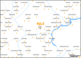
Mulè (Shan, Myanmar)Mulè is a town in the Shan region of Myanmar. An overview map of the region around Mulè is displayed below.
regional and 3d topo map of Mulè, Myanmar ::
Mulè airports ::
The nearest airport is LSH - Lashio, located 72.9 km north east of Mulè.
Other airports nearby include MDL - Mandalay Intl (158.1 km south west), HEH - Heho (207.3 km south), Nearby towns ::
Tonghkam (1.9km south) //
Hkumpen (1.7km west) //
Nāpang (1.7km east) //
Lauhkum (2.5km south east) //
Nawng-ang (3.7km south) //
Tunhsio (3.4km east) //
Pāngti (3.4km east) //
Namputong (4.1km south west) //
Ngwanhsai (4.1km south east) //
Hsun-oi (4.1km south east) //
Te-san (3.9km south east) //
Hawngheng (5.0km south west) //
Htinglong (5.6km south) //
Mānmon (5.5km east) //
Tā-hkam (5.5km west) //
Umkyeng (5.8km north) //
Um-mu (5.8km north) //
Hpaipen (5.8km south) //
Pāngyaung (6.3km south east) //
Loi-un (6.3km north west) //
Tunhsao (6.5km south east) //
Bawgyo (6.8km east) //
Möngleng (6.8km east) //
Hpa-hsengkio (7.1km east) //
Namhong (7.1km east) //
Namhsim (7.6km south east) //
Namyün (7.6km north west) //
Mān Mao (8.2km south east) //
Nā-heng (8.2km south east) //
[all distances 'as the bird flies' and approximate] 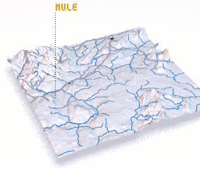 Places with similar names to Mulè, Myanmar ::
Disclaimer :: Information on this page comes without warranty of any kind |
||
|
Where is Mulè? Elevation and coordinates ::
Latitude (lat): 22°35'0"N Longitude (lon): 97°11'0"E
Elevation (approx.): 745m (map arrows pan, magnifying glasses zoom) |
||
|
Visiting Mulè? Hotel/Accommodation ::
Book a hotel in Mulè Travel Guide ::
Buy a travel guide for Myanmar rental cars ::
car rental offers GPS waypoint ::
download a GPX waypoint (PoI) of Mulè for your GPS receiver
|
||