|
search place name
|
||
Myaungyogyi (Myanmar)Myaungyogyi is a town in Myanmar. An overview map of the region around Myaungyogyi is displayed below.
regional and 3d topo map of Myaungyogyi, Myanmar ::

Myaungyogyi airports ::
The nearest airport is HEH - Heho, located 213.6 km north of Myaungyogyi.
Other airports nearby include RGN - Yangon Intl (217.9 km south), Nearby towns ::
Yeshan (0.0km north) //
Sigyizwe (1.8km east) //
Kywegan (1.8km east) //
Kyaungzu (1.9km south) //
Kyangin (1.9km south) //
Wetkon (2.6km south east) //
Singyi (3.7km south) //
Shwekyaunggon (4.0km south east) //
Bawdigon (4.1km south east) //
Daungthaik (4.1km south east) //
Shwelaung (5.1km north west) //
Thanbo (5.1km south east) //
Yetho (5.1km south east) //
Bon (5.8km south) //
Kyettaiknyaungbin (5.8km north) //
Tabetkwe (5.6km west) //
Natthangwin (5.6km west) //
Pinya (5.8km south) //
Talokkon (5.6km east) //
Paukkon (5.8km south) //
Kyauktan (5.6km west) //
Yeni (6.4km north east) //
Bogon (6.6km north west) //
Thada (6.6km north west) //
Hlezu (6.6km south east) //
We-gyi (6.6km north east) //
Singondaing (6.4km south east) //
Letpangon (6.4km south west) //
Pabewa (7.4km north) //
[all distances 'as the bird flies' and approximate] 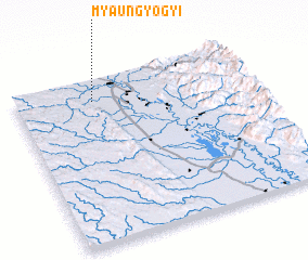 Places with similar names to Myaungyogyi, Myanmar ::
// Myaungyogyi (MM)
// Myaungyogyi (MM)
Disclaimer :: Information on this page comes without warranty of any kind |
||
|
Where is Myaungyogyi? Elevation and coordinates ::
Latitude (lat): 18°52'0"N Longitude (lon): 96°20'0"E
Elevation (approx.): 58m (map arrows pan, magnifying glasses zoom) |
||
|
Visiting Myaungyogyi? Hotel/Accommodation ::
Book a hotel in Myaungyogyi Travel Guide ::
Buy a travel guide for Myanmar rental cars ::
car rental offers GPS waypoint ::
download a GPX waypoint (PoI) of Myaungyogyi for your GPS receiver
|
||