|
search place name
|
||
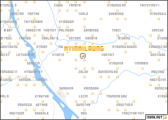
Myinmilaung (Sagaing, Myanmar)Myinmilaung is a town in the Sagaing region of Myanmar. An overview map of the region around Myinmilaung is displayed below.
regional and 3d topo map of Myinmilaung, Myanmar ::
Myinmilaung airports ::
The nearest airport is MDL - Mandalay Intl, located 97.9 km south east of Myinmilaung.
Other airports nearby include HEH - Heho (230.4 km south east), Nearby towns ::
Kyauksitpon Myauk (0.0km north) //
Kyauksitpon (1.9km south) //
Kyauksitpon Taung (1.9km south) //
Mingalagon (1.9km south) //
Taungbalu (1.7km west) //
Kanma (2.5km south west) //
Ettaw (2.5km south west) //
Kantha (2.5km south west) //
Budaunggan (2.5km south east) //
Zalok (3.7km south) //
Shabaukkon (3.7km north) //
Thamanza (3.9km north west) //
Kothan (4.1km north west) //
Yinban Anauk (4.1km north west) //
Tegyigon Ashe (4.1km north east) //
Kanbya (4.1km north east) //
Ywadon (5.1km south east) //
Kywèyè (5.1km west) //
Pamedaw (5.1km east) //
Pyangya (5.1km east) //
Yeganzu (5.1km east) //
Ywathit (5.1km east) //
Danbindè (5.8km north) //
Palingon (6.5km north west) //
Aukseindaw (6.3km south east) //
Gyogyagan (7.4km north) //
Kaingdaw (7.6km south) //
Kyaukka (7.1km east) //
Shaukka (8.2km south west) //
[all distances 'as the bird flies' and approximate]  Places with similar names to Myinmilaung, Myanmar :: Disclaimer :: Information on this page comes without warranty of any kind |
||
|
Where is Myinmilaung? Elevation and coordinates ::
Latitude (lat): 22°11'0"N Longitude (lon): 95°11'0"E
Elevation (approx.): 109m (map arrows pan, magnifying glasses zoom) |
||
|
Visiting Myinmilaung? Hotel/Accommodation ::
Book a hotel in Myinmilaung Travel Guide ::
Buy a travel guide for Myanmar rental cars ::
car rental offers GPS waypoint ::
download a GPX waypoint (PoI) of Myinmilaung for your GPS receiver
|
||