|
search place name
|
||
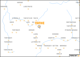
Nanhe (Sagaing, Myanmar)Nanhe is a town in the Sagaing region of Myanmar. An overview map of the region around Nanhe is displayed below.
regional and 3d topo map of Nanhe, Myanmar ::
Nanhe airports ::
The nearest airport is MYT - Myitkyina, located 190.1 km north east of Nanhe.
Other airports nearby include IMF - Imphal (190.1 km west), Nearby towns ::
Shwehnit (2.5km north west) //
Mangon (3.8km south west) //
Chaungzon (3.8km north west) //
Lwin-u (4.1km south west) //
Takye (4.1km north west) //
Lemi (5.4km west) //
Segyi (5.8km south) //
Thayetkon (6.3km north west) //
Shwegyaung (7.6km south) //
Letpangyin (7.6km south) //
Khopyin (7.5km south east) //
Pinmana (7.7km south east) //
Pinbon (7.7km north west) //
[all distances 'as the bird flies' and approximate] 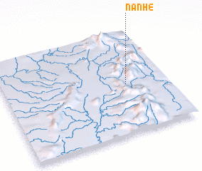 Places with similar names to Nanhe, Myanmar ::
Disclaimer :: Information on this page comes without warranty of any kind |
||
|
Where is Nanhe? Elevation and coordinates ::
Latitude (lat): 24°29'0"N Longitude (lon): 95°45'0"E
Elevation (approx.): 282m (map arrows pan, magnifying glasses zoom) |
||
|
Visiting Nanhe? Hotel/Accommodation ::
Book a hotel in Nanhe Travel Guide ::
Buy a travel guide for Myanmar rental cars ::
car rental offers GPS waypoint ::
download a GPX waypoint (PoI) of Nanhe for your GPS receiver
|
||