|
search place name
|
||
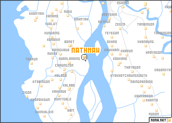
Nathmaw (Mon State, Myanmar)Nathmaw is a town in the Mon State region of Myanmar. An overview map of the region around Nathmaw is displayed below.
regional and 3d topo map of Nathmaw, Myanmar ::
Nathmaw airports ::
The nearest airport is RGN - Yangon Intl, located 165.8 km west of Nathmaw.
Other airports nearby include LPT - Lampang (293.3 km north east), Nearby towns ::
Kwanlamaing (3.5km west) //
Kharaikthit (3.7km south west) //
Thetkaw (4.7km north west) //
Chaungzon (4.9km west) //
Bonet (4.9km north west) //
Kalaukkanaing (5.2km south west) //
Paingkada (5.5km west) //
Kawkhani (5.6km east) //
Kyakhat (5.8km east) //
Okhpo (6.4km north east) //
Kalado (6.6km south west) //
Mayan (6.8km south west) //
Kalabe (7.1km south west) //
Pa-auk (6.9km east) //
Mukwe (7.0km west) //
Kawpala (7.4km north) //
Kawkame (7.1km east) //
Ya-khainggon (7.3km east) //
Winsein (7.4km west) //
Teyegon (7.5km north east) //
Kamanin (7.8km north west) //
Hpanhpa (8.0km south west) //
Muyitkyi (8.1km south west) //
Kahnyaw (8.4km north) //
Mutpun (8.7km north east) //
Kharun (8.7km east) //
Kundaing (8.9km north west) //
Kawkade (9.4km south west) //
Zegyo (10.1km north east) //
[all distances 'as the bird flies' and approximate] 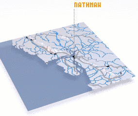 Places with similar names to Nathmaw, Myanmar ::
Disclaimer :: Information on this page comes without warranty of any kind |
||
|
Where is Nathmaw? Elevation and coordinates ::
Latitude (lat): 16°22'8"N Longitude (lon): 97°34'59"E
Elevation (approx.): 5m (map arrows pan, magnifying glasses zoom) |
||
|
Visiting Nathmaw? Hotel/Accommodation ::
Book a hotel in Nathmaw Travel Guide ::
Buy a travel guide for Myanmar rental cars ::
car rental offers GPS waypoint ::
download a GPX waypoint (PoI) of Nathmaw for your GPS receiver
|
||