|
search place name
|
||
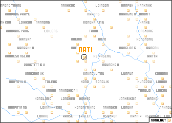
Nā-ti (Shan, Myanmar)Nā-ti is a town in the Shan region of Myanmar. An overview map of the region around Nā-ti is displayed below.
regional and 3d topo map of Nā-ti, Myanmar ::
Nā-ti airports ::
The nearest airport is HEH - Heho, located 135.6 km south west of Nā-ti.
Other airports nearby include LSH - Lashio (139.1 km north), MDL - Mandalay Intl (164.4 km west), MOG - Mong Hsat (221.3 km south east), Nearby towns ::
Hwè-taw (0.0km north) //
Wān Makmun (1.9km south) //
Hwè-nio (1.7km west) //
Namhen (1.7km west) //
Wān Kawng (1.7km west) //
Kunna (2.5km south east) //
Mān-sawk (2.5km south east) //
Hwè-noi (2.5km north west) //
Hsiphseng (3.4km east) //
Wān Kyong (3.7km south) //
Kawngmu-tau (4.1km south east) //
Wan Hkai (4.1km south east) //
Hwè-noi (4.1km north west) //
Ho-to (5.1km north east) //
Nam-kom (5.1km north east) //
Nā-hi (5.6km north) //
Ho-nā (5.6km south) //
Nawnghpa (5.5km east) //
Tai-na (5.8km north) //
Nawnghkam (5.8km south) //
Sanglik (6.5km south east) //
Nampong (7.6km south) //
Konghai-ping (7.6km north) //
Nawng-hkam (8.2km south west) //
Loi-leng (8.8km north west) //
Hki-hkaw (9.0km north east) //
Man Chengnoi (8.8km north west) //
To-leng (8.9km south west) //
Wān Nā (10.1km south west) //
[all distances 'as the bird flies' and approximate]  Places with similar names to Nā-ti, Myanmar ::
Disclaimer :: Information on this page comes without warranty of any kind |
||
|
Where is Nā-ti? Elevation and coordinates ::
Latitude (lat): 21°44'0"N Longitude (lon): 97°34'0"E
Elevation (approx.): 1148m (map arrows pan, magnifying glasses zoom) |
||
|
Visiting Nā-ti? Hotel/Accommodation ::
Book a hotel in Nā-ti Travel Guide ::
Buy a travel guide for Myanmar rental cars ::
car rental offers GPS waypoint ::
download a GPX waypoint (PoI) of Nā-ti for your GPS receiver
|
||