|
search place name
|
||
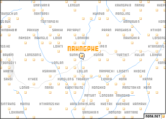
Nawngpwe (Shan, Myanmar)Nawngpwe is a town in the Shan region of Myanmar. An overview map of the region around Nawngpwe is displayed below.
regional and 3d topo map of Nawngpwe, Myanmar ::
Nawngpwe airports ::
The nearest airport is HEH - Heho, located 41.2 km west of Nawngpwe.
Other airports nearby include MDL - Mandalay Intl (160.1 km north west), Nearby towns ::
Sunmi (1.7km west) //
Hopong (1.9km south) //
Mān Kong (2.5km south west) //
Nawngkaw (3.7km north) //
Lonhkok (3.7km north) //
Loi-lun (3.7km south) //
Mönglawng (3.5km east) //
Kunna (3.5km east) //
Na-hkai (4.1km north west) //
Hke-nu (4.1km north west) //
Mān Mè-le (4.1km south west) //
Pa-leng (3.9km south west) //
Mān Hitmawng (4.1km south east) //
Suphu (3.9km north east) //
Wān Pa-pan (3.9km north east) //
Nammau-hun (5.1km north east) //
Mān Mai (5.1km south east) //
Ho-nam (5.2km east) //
Nawngyāsai (5.6km north) //
Pawngleng (5.6km south) //
Nawnghkom (5.6km north) //
Tadagyi (5.6km south) //
Paya-put (5.8km north) //
Tunti (5.8km south) //
Loi-hti (5.5km west) //
Lonlan (5.5km west) //
Loi-un (6.4km north west) //
Kung-leng (6.6km south west) //
Nampa-chi (6.4km south east) //
[all distances 'as the bird flies' and approximate]  Places with similar names to Nawngpwe, Myanmar :: Disclaimer :: Information on this page comes without warranty of any kind |
||
|
Where is Nawngpwe? Elevation and coordinates ::
Latitude (lat): 20°48'0"N Longitude (lon): 97°11'0"E
Elevation (approx.): 1092m (map arrows pan, magnifying glasses zoom) |
||
|
Visiting Nawngpwe? Hotel/Accommodation ::
Book a hotel in Nawngpwe Travel Guide ::
Buy a travel guide for Myanmar rental cars ::
car rental offers GPS waypoint ::
download a GPX waypoint (PoI) of Nawngpwe for your GPS receiver
|
||