|
search place name
|
||
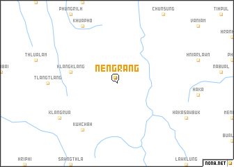
Nengrang (Chin, Myanmar)Nengrang is a town in the Chin region of Myanmar. An overview map of the region around Nengrang is displayed below.
regional and 3d topo map of Nengrang, Myanmar ::
Nengrang airports ::
The nearest airport is AJL - Aizwal Aizawl, located 139.3 km north west of Nengrang.
Other airports nearby include CGP - Chittagong Shah Amanat Intl (179.6 km west), CXB - Cox's Bazar Coxs Bazar (207.9 km south west), IXH - Kailashahar (237.3 km north west), Nearby towns ::
Klangklang (7.1km west) //
Kuhchah (9.0km south west) //
[all distances 'as the bird flies' and approximate] 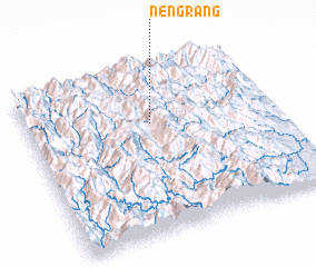 Places with similar names to Nengrang, Myanmar ::
// Ningrawng (MM)
// Ningrawng (MM)
// Ningrinhku (MM)
// Nang Rong (TH)
// Nangarangui (ID)
// Nanggerang (ID)
// Nanggerang (ID)
// Ningoranga (GA)
// Nanggerang (ID)
Disclaimer :: Information on this page comes without warranty of any kind |
||
|
Where is Nengrang? Elevation and coordinates ::
Latitude (lat): 22°40'0"N Longitude (lon): 93°30'0"E
Elevation (approx.): 1564m (map arrows pan, magnifying glasses zoom) |
||
|
Visiting Nengrang? Hotel/Accommodation ::
Book a hotel in Nengrang Travel Guide ::
Buy a travel guide for Myanmar rental cars ::
car rental offers GPS waypoint ::
download a GPX waypoint (PoI) of Nengrang for your GPS receiver
|
||