|
search place name
|
||
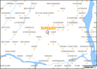
Nipadan (Sagaing, Myanmar)Nipadan is a town in the Sagaing region of Myanmar. An overview map of the region around Nipadan is displayed below.
regional and 3d topo map of Nipadan, Myanmar ::
Nipadan airports ::
The nearest airport is MDL - Mandalay Intl, located 104.3 km east of Nipadan.
Other airports nearby include HEH - Heho (227.6 km south east), Nearby towns ::
Padu (1.7km east) //
Yewin (1.7km east) //
Thitpinzu (3.7km south) //
Thamadaw (3.7km north) //
Kanni (3.9km south west) //
Aungchantha (3.9km north east) //
Yemein (4.1km south east) //
Ywathitkon (4.1km north east) //
Thazi (5.1km south east) //
Kywegodaw (5.1km north east) //
Sinbyuchi (5.1km north east) //
Yonbinyo (5.5km east) //
Pauktaw (6.4km north east) //
Kyaingkamauk (6.9km west) //
Shwethamin (7.4km north) //
Mindaw (7.1km east) //
Chaungyo (7.1km west) //
Thanbo (7.6km south east) //
Ngwetha (7.6km south east) //
Sonda (7.6km south west) //
Aleywa (8.2km north west) //
Pyawbwe (7.8km north east) //
Myezun (7.8km north east) //
Yinbaungdaing (10.1km south east) //
[all distances 'as the bird flies' and approximate] 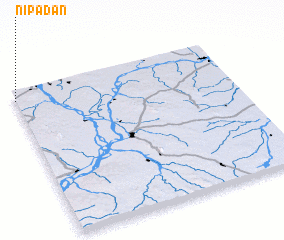 Places with similar names to Nipadan, Myanmar ::
Disclaimer :: Information on this page comes without warranty of any kind |
||
|
Where is Nipadan? Elevation and coordinates ::
Latitude (lat): 21°56'0"N Longitude (lon): 95°0'0"E
Elevation (approx.): 141m (map arrows pan, magnifying glasses zoom) |
||
|
Visiting Nipadan? Hotel/Accommodation ::
Book a hotel in Nipadan Travel Guide ::
Buy a travel guide for Myanmar rental cars ::
car rental offers GPS waypoint ::
download a GPX waypoint (PoI) of Nipadan for your GPS receiver
|
||