|
search place name
|
||
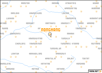
Nongmang (Shan, Myanmar)Nongmang is a town in the Shan region of Myanmar. An overview map of the region around Nongmang is displayed below.
regional and 3d topo map of Nongmang, Myanmar ::
Nongmang airports ::
The nearest airport is LSH - Lashio, located 114.5 km west of Nongmang.
Other airports nearby include KET - Kengtung (209.2 km south), Nearby towns ::
Mān Hkum (0.0km north) //
Mān Hsang (1.7km east) //
Ving Panghkawn (2.5km north west) //
Mān Tawng (3.7km north) //
Mān Hleik (4.1km north east) //
Namheng (3.9km north west) //
Mān Hpüng (3.9km south west) //
Yung Ka-lun (5.8km south) //
Kawngkuntao (5.4km west) //
Nam-awk (5.4km west) //
Yung Kla (5.4km east) //
Kawngkyi (6.3km north east) //
Yawng-hkrum (6.3km south west) //
Yungpang (6.3km south east) //
Ra-hawk (6.8km east) //
Mān Naut (7.6km south) //
Möng Het (7.8km north west) //
Mān Hawng (7.8km south west) //
Hpangrün (8.2km south east) //
Yawngprim (8.8km north east) //
Loi-chin (9.0km north east) //
Kawngchung (9.0km north west) //
Mankwei-long (9.0km south west) //
Na-hkang (10.1km north west) //
[all distances 'as the bird flies' and approximate] 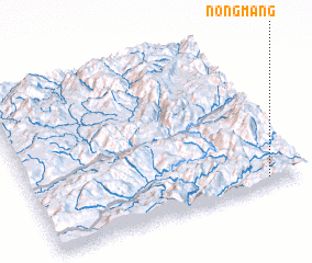 Places with similar names to Nongmang, Myanmar ::
Disclaimer :: Information on this page comes without warranty of any kind |
||
|
Where is Nongmang? Elevation and coordinates ::
Latitude (lat): 23°3'0"N Longitude (lon): 98°52'0"E
Elevation (approx.): 1120m (map arrows pan, magnifying glasses zoom) |
||
|
Visiting Nongmang? Hotel/Accommodation ::
Book a hotel in Nongmang Travel Guide ::
Buy a travel guide for Myanmar rental cars ::
car rental offers GPS waypoint ::
download a GPX waypoint (PoI) of Nongmang for your GPS receiver
|
||