|
search place name
|
||
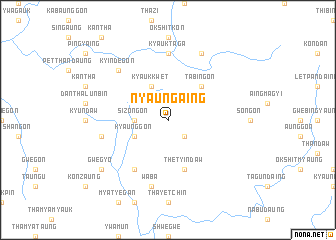
Nyaungaing (Myanmar)Nyaungaing is a town in Myanmar. An overview map of the region around Nyaungaing is displayed below.
regional and 3d topo map of Nyaungaing, Myanmar ::
Nyaungaing airports ::
The nearest airport is MDL - Mandalay Intl, located 129.7 km north east of Nyaungaing.
Other airports nearby include HEH - Heho (138.7 km east), KYP - Kyaukpyu (242.3 km south west), Nearby towns ::
Padawgyin (2.5km south east) //
Sizongon (3.5km west) //
Kyaunggon (3.9km south west) //
Kyaukkwet (4.1km north west) //
Tabingon (5.1km north east) //
Thetyindaw (5.8km south) //
Thinbandaw (6.6km south west) //
Kyauktaga (7.4km north) //
Waba (7.6km south) //
Shwebandaw (7.2km west) //
Kyindegon (7.6km north west) //
Pettaw (8.2km north east) //
Gwegyo (8.9km south west) //
[all distances 'as the bird flies' and approximate] 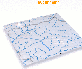 Places with similar names to Nyaungaing, Myanmar ::
// Nyaung Aing (MM)
// Nyaung-aing (MM)
// Nyaung-aing (MM)
// Nyaung-aing (MM)
// Nyaungaing (MM)
// Nyaungaing (MM)
// Nyaungaing (MM)
// Nyaunggaing (MM)
// Nyaunggaing (MM)
// Nyaunggaing (MM)
Disclaimer :: Information on this page comes without warranty of any kind |
||
|
Where is Nyaungaing? Elevation and coordinates ::
Latitude (lat): 20°38'0"N Longitude (lon): 95°28'0"E
Elevation (approx.): 308m (map arrows pan, magnifying glasses zoom) |
||
|
Visiting Nyaungaing? Hotel/Accommodation ::
Book a hotel in Nyaungaing Travel Guide ::
Buy a travel guide for Myanmar rental cars ::
car rental offers GPS waypoint ::
download a GPX waypoint (PoI) of Nyaungaing for your GPS receiver
|
||