|
search place name
|
||
Nyaunghla (Myanmar)Nyaunghla is a town in Myanmar. An overview map of the region around Nyaunghla is displayed below.
regional and 3d topo map of Nyaunghla, Myanmar ::

Nyaunghla airports ::
The nearest airport is KYP - Kyaukpyu, located 170.1 km south west of Nyaunghla.
Other airports nearby include MDL - Mandalay Intl (191.2 km north east), AKY - Sittwe (206.3 km west), HEH - Heho (208.9 km east), SNW - Thandwe (216.5 km south), Nearby towns ::
Yathagon (0.0km north) //
Kyauktan (1.7km west) //
Chinbyitpin (1.7km east) //
Mayogon (1.7km east) //
Chunzu (1.9km south) //
Kataung (2.5km south west) //
Nyaunggon (2.5km south west) //
Yegyanzin (2.5km north east) //
Okshitkon (4.1km south west) //
Thigon (4.1km south west) //
Tanaunggon (4.1km south west) //
Leeinzu (4.1km north east) //
Minzan (3.9km north west) //
Thamingyan (3.9km north west) //
Thapandan (3.9km north west) //
Tuywa (5.8km north) //
Semon (5.5km east) //
Nyaunggon (5.5km east) //
Buthi (5.5km west) //
Ywathit (5.5km west) //
Konzu (6.4km south east) //
Pindon (6.6km north west) //
Kanthit (7.4km south) //
Kyaungdawya (7.2km west) //
Hngatawgon (7.6km north) //
Thanatpinzu (7.6km south east) //
Kanzwe (7.9km south west) //
Zetagu (7.9km south west) //
Yonzeik (7.9km north east) //
[all distances 'as the bird flies' and approximate] 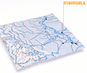 Places with similar names to Nyaunghla, Myanmar ::
Disclaimer :: Information on this page comes without warranty of any kind |
||
|
Where is Nyaunghla? Elevation and coordinates ::
Latitude (lat): 20°21'0"N Longitude (lon): 94°50'0"E
Elevation (approx.): 44m (map arrows pan, magnifying glasses zoom) |
||
|
Visiting Nyaunghla? Hotel/Accommodation ::
Book a hotel in Nyaunghla Travel Guide ::
Buy a travel guide for Myanmar rental cars ::
car rental offers GPS waypoint ::
download a GPX waypoint (PoI) of Nyaunghla for your GPS receiver
|
||