|
search place name
|
||
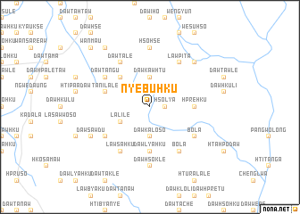
Nye-bu-hku (Kayah, Myanmar)Nye-bu-hku is a town in the Kayah region of Myanmar. An overview map of the region around Nye-bu-hku is displayed below.
regional and 3d topo map of Nye-bu-hku, Myanmar ::
Nye-bu-hku airports ::
The nearest airport is HEH - Heho, located 147.3 km north of Nye-bu-hku.
Other airports nearby include MOG - Mong Hsat (235.2 km north east), Nearby towns ::
Dawhpu (1.9km north) //
Hso-lya (1.7km east) //
Dawkaw-htu (3.7km north) //
Dawka-lo-so (3.7km south) //
La-li-lè (4.0km south west) //
Dawhsaw-do (5.1km north west) //
Dawlya-hku (5.6km south) //
Hpre-hku (5.2km east) //
Ta-ni-la-lè (5.6km west) //
Hpya-lya (6.4km south west) //
Daw Ta-ngu (6.4km north west) //
Lawsa-hku (6.6km south west) //
Dawta-lè (6.6km north west) //
Bo-la (6.4km south east) //
Law-pi-ta (6.6km north east) //
Bo-la (6.6km south east) //
Dawhso-klè (7.4km south) //
Hso-hsè (7.4km north) //
Dawklaw-tu (7.6km north east) //
Wān Kang-na (7.6km north east) //
Hto-hpo-klo (7.9km south west) //
Dawplè (7.9km south west) //
Dawsawdu (7.9km south west) //
Namhu-twi (9.1km north west) //
Wān Maü (10.2km north west) //
[all distances 'as the bird flies' and approximate]  Places with similar names to Nye-bu-hku, Myanmar ::
Disclaimer :: Information on this page comes without warranty of any kind |
||
|
Where is Nye-bu-hku? Elevation and coordinates ::
Latitude (lat): 19°30'0"N Longitude (lon): 97°17'0"E
Elevation (approx.): 1077m (map arrows pan, magnifying glasses zoom) |
||
|
Visiting Nye-bu-hku? Hotel/Accommodation ::
Book a hotel in Nye-bu-hku Travel Guide ::
Buy a travel guide for Myanmar rental cars ::
car rental offers GPS waypoint ::
download a GPX waypoint (PoI) of Nye-bu-hku for your GPS receiver
|
||