|
search place name
|
||
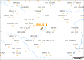
Omlait (Shan, Myanmar)Omlait is a town in the Shan region of Myanmar. An overview map of the region around Omlait is displayed below.
regional and 3d topo map of Omlait, Myanmar ::
Omlait airports ::
The nearest airport is LSH - Lashio, located 121.1 km west of Omlait.
Other airports nearby include KET - Kengtung (198.1 km south), Nearby towns ::
Hpangrün (3.9km north west) //
Möng Mao (3.9km south east) //
Mān Sung (3.9km south east) //
Kathi-no (5.0km south west) //
Toktat (5.1km east) //
Ngekwa (5.6km south) //
Mān Naut (5.4km west) //
Yungpang (5.8km north) //
Kyonno (5.8km north) //
Yung Ka-lun (6.3km north west) //
Kawng-hsang (6.5km north east) //
Mān Sang (6.5km south east) //
Hpaktu-lin (6.8km west) //
Yung Kla (7.6km north) //
Ho-mong (7.6km south) //
Ngitma-ro (7.6km north east) //
Yawngp'ru (7.6km south west) //
[all distances 'as the bird flies' and approximate] 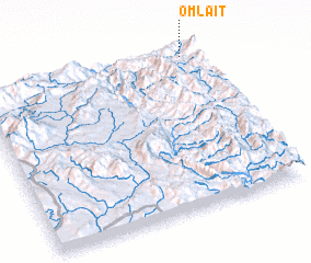 Places with similar names to Omlait, Myanmar ::
Disclaimer :: Information on this page comes without warranty of any kind |
||
|
Where is Omlait? Elevation and coordinates ::
Latitude (lat): 22°58'0"N Longitude (lon): 98°56'0"E
Elevation (approx.): 1207m (map arrows pan, magnifying glasses zoom) |
||
|
Visiting Omlait? Hotel/Accommodation ::
Book a hotel in Omlait Travel Guide ::
Buy a travel guide for Myanmar rental cars ::
car rental offers GPS waypoint ::
download a GPX waypoint (PoI) of Omlait for your GPS receiver
|
||