|
search place name
|
||
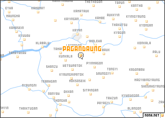
Pagandaung (Yangon, Myanmar)Pagandaung is a town in the Yangon region of Myanmar. An overview map of the region around Pagandaung is displayed below.
regional and 3d topo map of Pagandaung, Myanmar ::
Pagandaung airports ::
The nearest airport is RGN - Yangon Intl, located 47.3 km west of Pagandaung.
Nearby towns ::
Letpadan (2.9km north west) //
Shwebozu (2.9km north east) //
Pyinmagon (3.2km south east) //
Wetsu Patok (3.3km south west) //
Kunkala (3.7km west) //
Winlewa (4.2km north east) //
Zwehtaw (5.0km south) //
Debauk (4.8km east) //
Kyaungmi Patok (5.1km south west) //
Nyaungbinkwin (5.2km north) //
Tamangyi (5.0km west) //
Kayan (5.8km north) //
Moksoseik (6.0km south) //
Daunggyi (6.2km south east) //
Shanzu (7.2km west) //
Tongyi (7.2km south east) //
Sitpingan (8.2km south) //
Kayingan (8.5km north) //
Okkan (8.8km south) //
Kambe (9.2km north east) //
Yebawgan (9.5km south west) //
Kyagan (9.6km north east) //
Kamapadaw (10.6km north west) //
Nanyaw (10.7km south west) //
Thakutsu (10.7km north east) //
Kyauktaing (11.2km south west) //
[all distances 'as the bird flies' and approximate] 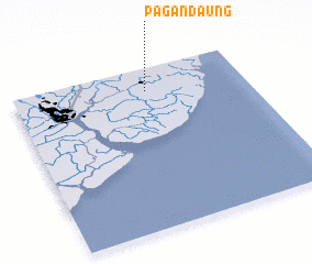 Places with similar names to Pagandaung, Myanmar ::
// Pekandoang (ID)
// Paegun-dong (KP)
// Paegun-dong (KP)
// Paegun-dong (KP)
// Paegun-dong (KP)
// Paegun-dong (KP)
// Paegun-dong (KP)
// Paegun-dong (KP)
// Pugundang (KP)
// Pukkan-dong (KP)
Disclaimer :: Information on this page comes without warranty of any kind |
||
|
Where is Pagandaung? Elevation and coordinates ::
Latitude (lat): 16°51'16"N Longitude (lon): 96°34'26"E
Elevation (approx.): 12m (map arrows pan, magnifying glasses zoom) |
||
|
Visiting Pagandaung? Hotel/Accommodation ::
Book a hotel in Pagandaung Travel Guide ::
Buy a travel guide for Myanmar rental cars ::
car rental offers GPS waypoint ::
download a GPX waypoint (PoI) of Pagandaung for your GPS receiver
|
||