|
search place name
|
||
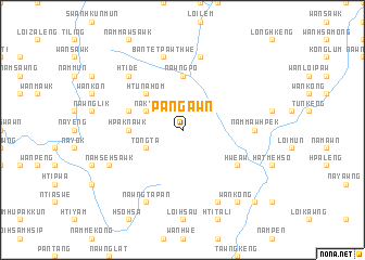
Pang-awn (Shan, Myanmar)Pang-awn is a town in the Shan region of Myanmar. An overview map of the region around Pang-awn is displayed below.
regional and 3d topo map of Pang-awn, Myanmar ::
Pang-awn airports ::
The nearest airport is HEH - Heho, located 69.8 km north west of Pang-awn.
Other airports nearby include MOG - Mong Hsat (193.7 km east), MDL - Mandalay Intl (200.1 km north west), Nearby towns ::
Loi-lem (3.9km south west) //
Tongta (3.9km south west) //
Na-kye (3.9km north west) //
Loi-hpaung (3.9km north west) //
Htu-na-hom (5.1km north west) //
Nawngpo (5.6km north) //
Lingleng (5.6km north) //
Hpaknawk (5.2km west) //
Nawnghwi (5.5km west) //
Loi-yawkya (6.4km south east) //
Hwe-aw (6.4km south east) //
Loipek (6.4km south east) //
Nammawhpek (6.9km east) //
Lat Kwe (7.6km north) //
Bàn Tet Paw Thwe (7.6km north) //
Hti De (7.6km north west) //
Loi-hsau (8.2km south east) //
Nawngta-pan (8.2km south west) //
Nāhsehsawk (7.9km south west) //
Wān Köng (9.1km south east) //
Nammawlong (10.2km south east) //
[all distances 'as the bird flies' and approximate] 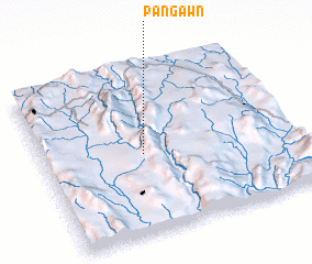 Places with similar names to Pang-awn, Myanmar ::
Disclaimer :: Information on this page comes without warranty of any kind |
||
|
Where is Pang-awn? Elevation and coordinates ::
Latitude (lat): 20°29'0"N Longitude (lon): 97°24'0"E
Elevation (approx.): 1487m (map arrows pan, magnifying glasses zoom) |
||
|
Visiting Pang-awn? Hotel/Accommodation ::
Book a hotel in Pang-awn Travel Guide ::
Buy a travel guide for Myanmar rental cars ::
car rental offers GPS waypoint ::
download a GPX waypoint (PoI) of Pang-awn for your GPS receiver
|
||