|
search place name
|
||
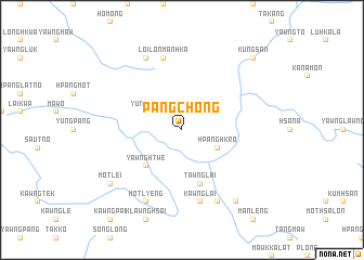
Pangchong (Shan, Myanmar)Pangchong is a town in the Shan region of Myanmar. An overview map of the region around Pangchong is displayed below.
regional and 3d topo map of Pangchong, Myanmar ::
Pangchong airports ::
The nearest airport is LSH - Lashio, located 127.8 km west of Pangchong.
Other airports nearby include KET - Kengtung (179.1 km south), Nearby towns ::
Yunghso (3.9km north west) //
Hpanghkro (3.9km south east) //
Yawnghtwe (5.0km south west) //
Tawnglai (5.8km south) //
Loi-lon Mānhka (7.6km north) //
Yawnghong (7.6km north) //
Kawnglai (7.6km south) //
Mān Pang (8.2km north west) //
Motlyeng (8.2km south west) //
Pawnglawng (8.2km south east) //
Motlei (8.8km south west) //
Hsa Awt Hum Hsum (9.0km south east) //
Kungsan (10.1km north east) //
[all distances 'as the bird flies' and approximate] 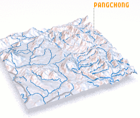 Places with similar names to Pangchong, Myanmar ::
// Pangchong (MM)
// Pongcheng (MM)
// P'ungch'ang (KP)
// P'eng-ch'eng (TW)
// P'ing-ching (TW)
// Pengchong (CN)
// Pingshang (CN)
// Pingshang (CN)
// Pengcheng (CN)
// Pengcheng (CN)
Disclaimer :: Information on this page comes without warranty of any kind |
||
|
Where is Pangchong? Elevation and coordinates ::
Latitude (lat): 22°48'0"N Longitude (lon): 98°59'0"E
Elevation (approx.): 1076m (map arrows pan, magnifying glasses zoom) |
||
|
Visiting Pangchong? Hotel/Accommodation ::
Book a hotel in Pangchong Travel Guide ::
Buy a travel guide for Myanmar rental cars ::
car rental offers GPS waypoint ::
download a GPX waypoint (PoI) of Pangchong for your GPS receiver
|
||