|
search place name
|
||
Pangthum (Shan, Myanmar)Pangthum is a town in the Shan region of Myanmar. An overview map of the region around Pangthum is displayed below.
regional and 3d topo map of Pangthum, Myanmar ::

Pangthum airports ::
The nearest airport is LSH - Lashio, located 31.3 km north east of Pangthum.
Other airports nearby include MDL - Mandalay Intl (202.5 km south west), HEH - Heho (235.3 km south), Nearby towns ::
Nam Kong (1.7km west) //
Hkai-mawn (1.9km north) //
Nawng-man (2.5km south west) //
Nam-mawng (2.5km south east) //
Pa-sa (2.5km north west) //
Pāng-hai (2.5km north east) //
Naung-koi (2.5km north east) //
Nam-ku (3.7km south) //
Nā-hkan-li (3.7km south) //
Nam-kyeng (3.7km north) //
Namhung (3.9km south west) //
Kawng-hong (3.9km north east) //
Naung-lang (3.9km north east) //
Naungmaunglu (4.1km north east) //
Naungbinsa (5.0km north east) //
Pöngga-taw (5.1km west) //
Mān Makha (5.6km north) //
Kaungkha (5.6km north) //
Na-sang (5.8km north) //
Mān Kāt (5.8km south) //
Kong-paw (5.8km north) //
Nā-hpot (5.8km north) //
Hang-na (5.8km south) //
Hön-lawn (5.8km south) //
Mān Sawk (5.8km south) //
Nam-ut (6.5km north west) //
Nā-lang (6.3km south west) //
Na-sonya (6.3km north west) //
Namhtam (7.4km south) //
[all distances 'as the bird flies' and approximate] 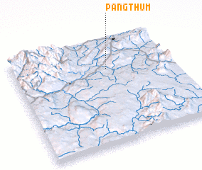 Places with similar names to Pangthum, Myanmar :: Disclaimer :: Information on this page comes without warranty of any kind |
||
|
Where is Pangthum? Elevation and coordinates ::
Latitude (lat): 22°44'0"N Longitude (lon): 97°36'0"E
Elevation (approx.): 665m (map arrows pan, magnifying glasses zoom) |
||
|
Visiting Pangthum? Hotel/Accommodation ::
Book a hotel in Pangthum Travel Guide ::
Buy a travel guide for Myanmar rental cars ::
car rental offers GPS waypoint ::
download a GPX waypoint (PoI) of Pangthum for your GPS receiver
|
||