|
search place name
|
||
Pathekongale (Myanmar)Pathekongale is a town in Myanmar. An overview map of the region around Pathekongale is displayed below.
regional and 3d topo map of Pathekongale, Myanmar ::

Pathekongale airports ::
The nearest airport is RGN - Yangon Intl, located 27.6 km south east of Pathekongale.
Other airports nearby include SNW - Thandwe (232.0 km north west), Nearby towns ::
Hmawbi (0.0km north) //
Thaungdaw (1.9km south) //
Thabawchaung (1.8km west) //
Lamudan Atet (3.7km south) //
Hnawgon (4.0km north east) //
Lamudan (4.1km south west) //
Alein Ale (4.1km north west) //
Okshitgon (4.1km north east) //
Gyogon (4.1km north east) //
Yedwingon (5.1km north west) //
Bonlonzeik (5.6km east) //
Myochaung (5.8km north) //
Lamudan Auk (5.8km south) //
Pettan (6.5km south east) //
Yegyaw (6.5km south west) //
Kyauksalitkon (6.5km south west) //
Pandaw (6.6km south east) //
Hlapada (7.1km east) //
Okpo (7.3km west) //
Payālan (7.3km east) //
Tantabin (8.2km south east) //
Kangale (8.2km north east) //
Gadatkon (9.1km north west) //
Yebawthe (9.0km south east) //
Nebyaw (10.3km south west) //
Duntabe (10.3km south east) //
Thayetkon (10.3km north east) //
Nyaunglebin (10.3km north west) //
[all distances 'as the bird flies' and approximate] 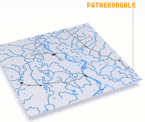 Places with similar names to Pathekongale, Myanmar :: Disclaimer :: Information on this page comes without warranty of any kind |
||
|
Where is Pathekongale? Elevation and coordinates ::
Latitude (lat): 17°5'0"N Longitude (lon): 95°57'0"E
Elevation (approx.): 9m (map arrows pan, magnifying glasses zoom) |
||
|
Visiting Pathekongale? Hotel/Accommodation ::
Book a hotel in Pathekongale Travel Guide ::
Buy a travel guide for Myanmar rental cars ::
car rental offers GPS waypoint ::
download a GPX waypoint (PoI) of Pathekongale for your GPS receiver
|
||