|
search place name
|
||
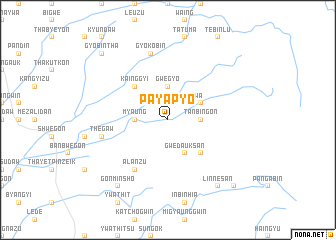
Payapyo (Myanmar)Payapyo is a town in Myanmar. An overview map of the region around Payapyo is displayed below.
regional and 3d topo map of Payapyo, Myanmar ::
Payapyo airports ::
The nearest airport is RGN - Yangon Intl, located 143.4 km south of Payapyo.
Other airports nearby include SNW - Thandwe (163.6 km west), Nearby towns ::
Chaunggwa (2.6km north east) //
Tanbingon (3.5km east) //
Gwegyo (3.7km north) //
Myaung (3.5km west) //
Winthayettaw (4.0km north east) //
Gwedauksan (4.1km south east) //
Seinpatle (5.1km south east) //
Kainggyi (5.1km north west) //
Teinhmyok (6.6km south west) //
Alanzu (6.6km south west) //
Gyokobin (7.6km north) //
Thegaw (7.3km west) //
Linnesan (9.1km south east) //
Gonminsho (9.1km south west) //
Gyobintha (10.2km north west) //
Seywa (10.2km south east) //
[all distances 'as the bird flies' and approximate] 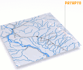
Disclaimer :: Information on this page comes without warranty of any kind |
||
|
Where is Payapyo? Elevation and coordinates ::
Latitude (lat): 18°10'0"N Longitude (lon): 95°49'0"E
Elevation (approx.): 43m (map arrows pan, magnifying glasses zoom) |
||
|
Visiting Payapyo? Hotel/Accommodation ::
Book a hotel in Payapyo Travel Guide ::
Buy a travel guide for Myanmar rental cars ::
car rental offers GPS waypoint ::
download a GPX waypoint (PoI) of Payapyo for your GPS receiver
|
||