|
search place name
|
||
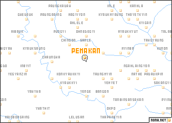
Pemakan (Myanmar)Pemakan is a town in Myanmar. An overview map of the region around Pemakan is displayed below.
regional and 3d topo map of Pemakan, Myanmar ::
Pemakan airports ::
The nearest airport is SNW - Thandwe, located 125.5 km south west of Pemakan.
Other airports nearby include KYP - Kyaukpyu (150.4 km west), HEH - Heho (242.3 km north east), Nearby towns ::
Sanle (3.7km north) //
Okmundaw (4.0km north east) //
Taungmyin (5.1km south east) //
Konkyaukkyi (5.1km south west) //
Chingon (5.1km north west) //
Ohnedegyi (5.6km north) //
Shanywagyaw (6.4km south east) //
Kyaukkyi (6.6km south west) //
Ye-nge (7.4km south) //
Chaungwa (7.0km west) //
Pegadin (7.2km east) //
Kadaing (7.2km east) //
Banbyin (7.2km east) //
Ahlele (7.6km north) //
Yemyet (7.6km south east) //
Thapangaing (7.6km south west) //
Taungbat (7.6km south west) //
Pungyi (7.6km north west) //
Bangon (8.2km south east) //
Alechaung (7.9km south west) //
Sanmagyi (8.9km north east) //
[all distances 'as the bird flies' and approximate] 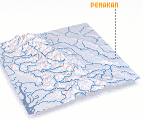 Places with similar names to Pemakan, Myanmar ::
Disclaimer :: Information on this page comes without warranty of any kind |
||
|
Where is Pemakan? Elevation and coordinates ::
Latitude (lat): 19°24'0"N Longitude (lon): 94°58'0"E
Elevation (approx.): 154m (map arrows pan, magnifying glasses zoom) |
||
|
Visiting Pemakan? Hotel/Accommodation ::
Book a hotel in Pemakan Travel Guide ::
Buy a travel guide for Myanmar rental cars ::
car rental offers GPS waypoint ::
download a GPX waypoint (PoI) of Pemakan for your GPS receiver
|
||