|
search place name
|
||
Pinkin (Shan, Myanmar)Pinkin is a town in the Shan region of Myanmar. An overview map of the region around Pinkin is displayed below.
regional and 3d topo map of Pinkin, Myanmar ::

Pinkin airports ::
The nearest airport is HEH - Heho, located 42.6 km north east of Pinkin.
Other airports nearby include MDL - Mandalay Intl (158.7 km north west), Nearby towns ::
Loi-ai (1.9km south) //
Palaw (1.9km north) //
Inni (2.5km south west) //
Tokke Pinthakwa (3.7km south) //
Hinkar (3.5km west) //
Taungkamauk (3.5km west) //
Metmon (3.9km south west) //
Taungsi (5.1km south east) //
Migat Kyauktwin (5.2km west) //
Po-tan (5.2km west) //
Setsubya (5.6km north) //
Kyauksin (5.6km north) //
Kaungwaing (5.8km south) //
Nawnglin (5.5km east) //
Sayanpya (5.5km west) //
Nawngmun (5.5km east) //
Tokke (5.8km south) //
Bampin (6.4km south east) //
Lonpo (6.4km south east) //
Shauksok (6.4km north west) //
Tansawng (6.4km north east) //
Alawngbauk (6.4km north west) //
Htiri (6.4km north east) //
Myinka (6.6km north west) //
Thegon (7.4km north) //
Nawngka (7.2km east) //
Munbin (7.2km east) //
Mye-cha (7.2km west) //
Mu-ya (7.6km south west) //
[all distances 'as the bird flies' and approximate] 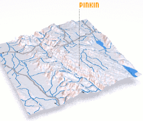 Places with similar names to Pinkin, Myanmar ::
Disclaimer :: Information on this page comes without warranty of any kind |
||
|
Where is Pinkin? Elevation and coordinates ::
Latitude (lat): 20°24'0"N Longitude (lon): 96°37'0"E
Elevation (approx.): 1303m (map arrows pan, magnifying glasses zoom) |
||
|
Visiting Pinkin? Hotel/Accommodation ::
Book a hotel in Pinkin Travel Guide ::
Buy a travel guide for Myanmar rental cars ::
car rental offers GPS waypoint ::
download a GPX waypoint (PoI) of Pinkin for your GPS receiver
|
||