|
search place name
|
||
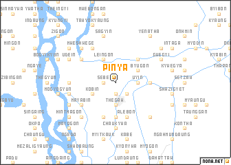
Pinya (Mandalay, Myanmar)Pinya is a town in the Mandalay region of Myanmar. An overview map of the region around Pinya is displayed below.
regional and 3d topo map of Pinya, Myanmar ::
Pinya airports ::
The nearest airport is MDL - Mandalay Intl, located 60.2 km south of Pinya.
Other airports nearby include HEH - Heho (179.5 km south east), LSH - Lashio (188.8 km north east), Nearby towns ::
Wegyi (1.9km south) //
Sebe (1.7km west) //
Tongon (1.7km west) //
Tanlebin (1.9km north) //
Madaya (2.5km south east) //
Zalokkyigon (2.5km north east) //
Thegaw (3.7km south) //
U-yin (3.4km east) //
Kobin (3.9km south west) //
Zibyugon (3.9km north east) //
Leingon (4.1km north west) //
Thayetchaung (5.1km north east) //
Kyatkon (5.6km south) //
Letkaunggyi (5.1km east) //
Taunggaing (5.8km south) //
Alebon (5.8km south) //
Sinywa (6.5km north west) //
Mayabin (6.3km south west) //
Ywathitgale (6.3km north west) //
Chaukywa (7.4km south) //
Samungon (6.9km west) //
Powa Taung (7.1km west) //
Sagyin (7.6km north) //
Mwehintha North (7.6km north west) //
Mwehintha (7.6km north west) //
Mweshwege (7.6km north west) //
Wehingama (7.6km south west) //
Sidainggan (7.6km south east) //
Shinhla Aleywa (7.8km south west) //
[all distances 'as the bird flies' and approximate] 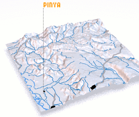 Places with similar names to Pinya, Myanmar ::
Disclaimer :: Information on this page comes without warranty of any kind |
||
|
Where is Pinya? Elevation and coordinates ::
Latitude (lat): 22°14'0"N Longitude (lon): 96°6'0"E
Elevation (approx.): 80m (map arrows pan, magnifying glasses zoom) |
||
|
Visiting Pinya? Hotel/Accommodation ::
Book a hotel in Pinya Travel Guide ::
Buy a travel guide for Myanmar rental cars ::
car rental offers GPS waypoint ::
download a GPX waypoint (PoI) of Pinya for your GPS receiver
|
||